You are here: Home > Network List > US - United States National Seismic Network Stations List
> Station AMTX Amarillo, Texas, USA > Earthquake Result Viewer
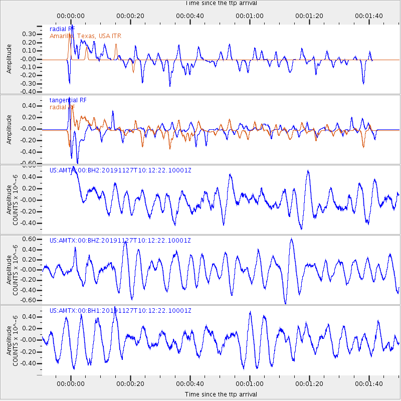
AMTX Amarillo, Texas, USA - Earthquake Result Viewer
*The percent match for this event was below the threshold and hence no stack was calculated.
| Earthquake location: |
South Of Fiji Islands |
| Earthquake latitude/longitude: |
-22.1/-179.5 |
| Earthquake time(UTC): |
2019/11/27 (331) 10:00:40 GMT |
| Earthquake Depth: |
570 km |
| Earthquake Magnitude: |
5.6 Mww |
| Earthquake Catalog/Contributor: |
NEIC PDE/us |
|
| Network: |
US United States National Seismic Network |
| Station: |
AMTX Amarillo, Texas, USA |
| Lat/Lon: |
34.53 N/101.41 W |
| Elevation: |
1010 m |
|
| Distance: |
93.0 deg |
| Az: |
53.989 deg |
| Baz: |
245.301 deg |
| Ray Param: |
$rayparam |
*The percent match for this event was below the threshold and hence was not used in the summary stack. |
|
| Radial Match: |
51.275383 % |
| Radial Bump: |
400 |
| Transverse Match: |
55.578705 % |
| Transverse Bump: |
400 |
| SOD ConfigId: |
19951751 |
| Insert Time: |
2019-12-11 10:14:19.018 +0000 |
| GWidth: |
2.5 |
| Max Bumps: |
400 |
| Tol: |
0.001 |
|
Signal To Noise
| Channel | StoN | STA | LTA |
| US:AMTX:00:BHZ:20191127T10:12:22.10001Z | 1.3403997 | 1.9503133E-7 | 1.4550236E-7 |
| US:AMTX:00:BH1:20191127T10:12:22.10001Z | 2.0363595 | 2.9308578E-7 | 1.4392634E-7 |
| US:AMTX:00:BH2:20191127T10:12:22.10001Z | 1.2636162 | 2.4308778E-7 | 1.923747E-7 |
| Arrivals |
| Ps | |
| PpPs | |
| PsPs/PpSs | |


