You are here: Home > Network List > TA - USArray Transportable Network (new EarthScope stations) Stations List
> Station POKR Poker Plat Research Range, AK, USA > Earthquake Result Viewer
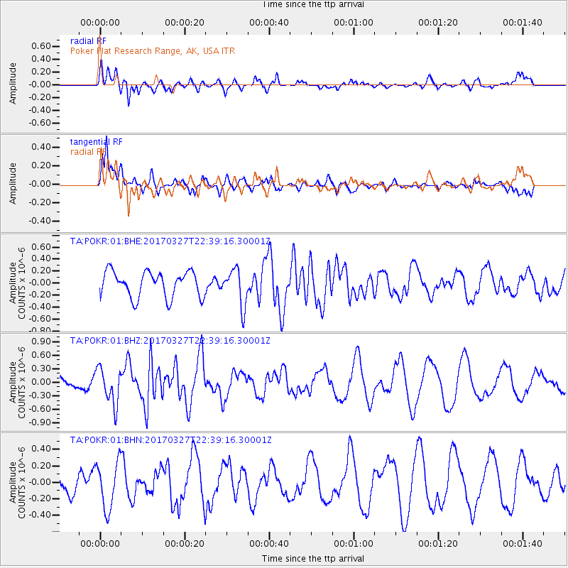
POKR Poker Plat Research Range, AK, USA - Earthquake Result Viewer
*The percent match for this event was below the threshold and hence no stack was calculated.
| Earthquake location: |
Eastern Sea Of Japan |
| Earthquake latitude/longitude: |
42.1/138.5 |
| Earthquake time(UTC): |
2017/03/27 (086) 22:31:21 GMT |
| Earthquake Depth: |
10 km |
| Earthquake Magnitude: |
5.1 Mww |
| Earthquake Catalog/Contributor: |
NEIC PDE/us |
|
| Network: |
TA USArray Transportable Network (new EarthScope stations) |
| Station: |
POKR Poker Plat Research Range, AK, USA |
| Lat/Lon: |
65.12 N/147.43 W |
| Elevation: |
501 m |
|
| Distance: |
46.3 deg |
| Az: |
34.264 deg |
| Baz: |
277.685 deg |
| Ray Param: |
$rayparam |
*The percent match for this event was below the threshold and hence was not used in the summary stack. |
|
| Radial Match: |
72.71143 % |
| Radial Bump: |
400 |
| Transverse Match: |
75.707466 % |
| Transverse Bump: |
400 |
| SOD ConfigId: |
2028011 |
| Insert Time: |
2017-04-10 22:35:57.162 +0000 |
| GWidth: |
2.5 |
| Max Bumps: |
400 |
| Tol: |
0.001 |
|
Signal To Noise
| Channel | StoN | STA | LTA |
| TA:POKR:01:BHZ:20170327T22:39:16.30001Z | 2.4941144 | 4.0611405E-7 | 1.6282895E-7 |
| TA:POKR:01:BHN:20170327T22:39:16.30001Z | 2.045227 | 2.888067E-7 | 1.412101E-7 |
| TA:POKR:01:BHE:20170327T22:39:16.30001Z | 1.4751076 | 3.1597847E-7 | 2.1420706E-7 |
| Arrivals |
| Ps | |
| PpPs | |
| PsPs/PpSs | |


