You are here: Home > Network List > TA - USArray Transportable Network (new EarthScope stations) Stations List
> Station F26K Sheenjek River, AK, USA > Earthquake Result Viewer
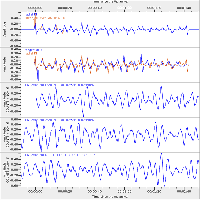
F26K Sheenjek River, AK, USA - Earthquake Result Viewer
*The percent match for this event was below the threshold and hence no stack was calculated.
| Earthquake location: |
Near Coast Of Guatemala |
| Earthquake latitude/longitude: |
13.9/-91.9 |
| Earthquake time(UTC): |
2019/11/30 (334) 07:44:25 GMT |
| Earthquake Depth: |
48 km |
| Earthquake Magnitude: |
5.6 Mww |
| Earthquake Catalog/Contributor: |
NEIC PDE/us |
|
| Network: |
TA USArray Transportable Network (new EarthScope stations) |
| Station: |
F26K Sheenjek River, AK, USA |
| Lat/Lon: |
67.69 N/144.15 W |
| Elevation: |
683 m |
|
| Distance: |
63.4 deg |
| Az: |
340.261 deg |
| Baz: |
120.788 deg |
| Ray Param: |
$rayparam |
*The percent match for this event was below the threshold and hence was not used in the summary stack. |
|
| Radial Match: |
66.61463 % |
| Radial Bump: |
400 |
| Transverse Match: |
56.7395 % |
| Transverse Bump: |
376 |
| SOD ConfigId: |
19951751 |
| Insert Time: |
2019-12-14 07:57:46.130 +0000 |
| GWidth: |
2.5 |
| Max Bumps: |
400 |
| Tol: |
0.001 |
|
Signal To Noise
| Channel | StoN | STA | LTA |
| TA:F26K: :BHZ:20191130T07:54:18.874989Z | 1.1772834 | 3.6483854E-7 | 3.0989867E-7 |
| TA:F26K: :BHN:20191130T07:54:18.874989Z | 0.7951077 | 1.5501827E-7 | 1.9496511E-7 |
| TA:F26K: :BHE:20191130T07:54:18.874989Z | 1.9699917 | 2.960669E-7 | 1.5028841E-7 |
| Arrivals |
| Ps | |
| PpPs | |
| PsPs/PpSs | |


