You are here: Home > Network List > IU - Global Seismograph Network (GSN - IRIS/USGS) Stations List
> Station PMG Port Moresby, New Guinea > Earthquake Result Viewer
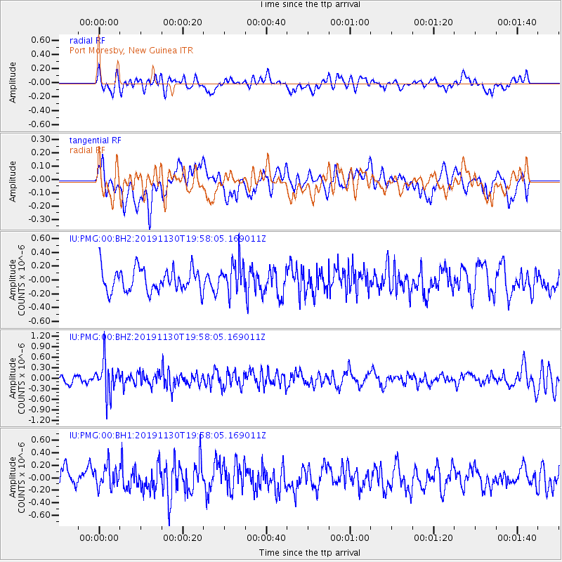
PMG Port Moresby, New Guinea - Earthquake Result Viewer
*The percent match for this event was below the threshold and hence no stack was calculated.
| Earthquake location: |
South Of Fiji Islands |
| Earthquake latitude/longitude: |
-26.7/178.3 |
| Earthquake time(UTC): |
2019/11/30 (334) 19:52:39 GMT |
| Earthquake Depth: |
608 km |
| Earthquake Magnitude: |
5.5 Mww |
| Earthquake Catalog/Contributor: |
NEIC PDE/us |
|
| Network: |
IU Global Seismograph Network (GSN - IRIS/USGS) |
| Station: |
PMG Port Moresby, New Guinea |
| Lat/Lon: |
9.40 S/147.16 E |
| Elevation: |
90 m |
|
| Distance: |
34.1 deg |
| Az: |
294.379 deg |
| Baz: |
124.303 deg |
| Ray Param: |
$rayparam |
*The percent match for this event was below the threshold and hence was not used in the summary stack. |
|
| Radial Match: |
48.523235 % |
| Radial Bump: |
400 |
| Transverse Match: |
52.85024 % |
| Transverse Bump: |
400 |
| SOD ConfigId: |
19951751 |
| Insert Time: |
2019-12-14 20:01:43.245 +0000 |
| GWidth: |
2.5 |
| Max Bumps: |
400 |
| Tol: |
0.001 |
|
Signal To Noise
| Channel | StoN | STA | LTA |
| IU:PMG:00:BHZ:20191130T19:58:05.169011Z | 4.8969526 | 4.6548584E-7 | 9.505622E-8 |
| IU:PMG:00:BH1:20191130T19:58:05.169011Z | 1.2874106 | 1.799559E-7 | 1.3978128E-7 |
| IU:PMG:00:BH2:20191130T19:58:05.169011Z | 1.3473775 | 2.2673923E-7 | 1.6828189E-7 |
| Arrivals |
| Ps | |
| PpPs | |
| PsPs/PpSs | |


