You are here: Home > Network List > TA - USArray Transportable Network (new EarthScope stations) Stations List
> Station Q17K Contact Creek, Katmai, AK, USA > Earthquake Result Viewer
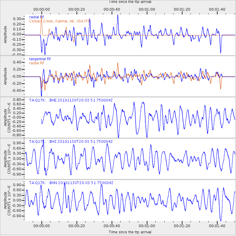
Q17K Contact Creek, Katmai, AK, USA - Earthquake Result Viewer
*The percent match for this event was below the threshold and hence no stack was calculated.
| Earthquake location: |
South Of Fiji Islands |
| Earthquake latitude/longitude: |
-26.7/178.3 |
| Earthquake time(UTC): |
2019/11/30 (334) 19:52:39 GMT |
| Earthquake Depth: |
608 km |
| Earthquake Magnitude: |
5.5 Mww |
| Earthquake Catalog/Contributor: |
NEIC PDE/us |
|
| Network: |
TA USArray Transportable Network (new EarthScope stations) |
| Station: |
Q17K Contact Creek, Katmai, AK, USA |
| Lat/Lon: |
58.26 N/155.89 W |
| Elevation: |
1165 m |
|
| Distance: |
87.3 deg |
| Az: |
13.305 deg |
| Baz: |
202.933 deg |
| Ray Param: |
$rayparam |
*The percent match for this event was below the threshold and hence was not used in the summary stack. |
|
| Radial Match: |
55.475914 % |
| Radial Bump: |
400 |
| Transverse Match: |
70.5339 % |
| Transverse Bump: |
400 |
| SOD ConfigId: |
19951751 |
| Insert Time: |
2019-12-14 20:02:45.294 +0000 |
| GWidth: |
2.5 |
| Max Bumps: |
400 |
| Tol: |
0.001 |
|
Signal To Noise
| Channel | StoN | STA | LTA |
| TA:Q17K: :BHZ:20191130T20:03:51.750004Z | 2.096641 | 6.2755186E-7 | 2.9931297E-7 |
| TA:Q17K: :BHN:20191130T20:03:51.750004Z | 1.3341764 | 4.7582373E-7 | 3.566423E-7 |
| TA:Q17K: :BHE:20191130T20:03:51.750004Z | 1.2081255 | 2.4614457E-7 | 2.037409E-7 |
| Arrivals |
| Ps | |
| PpPs | |
| PsPs/PpSs | |


