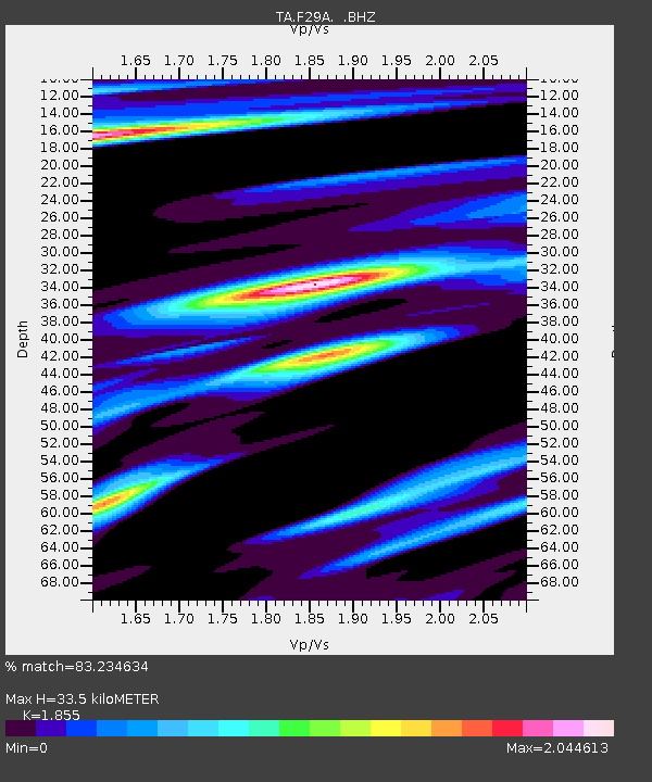
F29A Eureka, SD, USA - Earthquake Result Viewer

Earthquake location: Fox Islands, Aleutian Islands
Earthquake latitude/longitude: 52.6/-167.1
Earthquake time(UTC): 2009/10/13 (286) 20:21:53 GMT
Earthquake Depth: 14 km
Earthquake Magnitude: 5.9 MB, 6.4 MS, 6.4 MW, 6.4 MW
Earthquake Catalog/Contributor: WHDF/NEIC
Network: TA USArray Transportable Network (new EarthScope stations)
Station: F29A Eureka, SD, USA
Lat/Lon: 45.83 N/99.83 W
Elevation: 575 m
Distance: 43.0 deg
Az: 70.993 deg
Baz: 304.434 deg
Ray Param: 0.07281504
Estimated Moho Depth: 33.5 km
Estimated Crust Vp/Vs: 1.86
Assumed Crust Vp: 6.53 km/s
Estimated Crust Vs: 3.52 km/s
Estimated Crust Poisson's Ratio: 0.30
Radial Match: 83.234634 %
Radial Bump: 400
Transverse Match: 52.519012 %
Transverse Bump: 400
SOD ConfigId: 2622
Insert Time: 2010-03-07 06:21:38.893 +0000
GWidth: 2.5
Max Bumps: 400
Tol: 0.001

Signal To Noise

ChannelStoNSTALTA
TA:F29A: :BHZ:20091013T20:29:21.200Z1.92949016.2871203E-73.2584364E-7
TA:F29A: :BHN:20091013T20:29:21.200Z1.28971067.4651075E-75.7882033E-7
TA:F29A: :BHE:20091013T20:29:21.200Z0.441847153.1258287E-77.074457E-7
Arrivals
Ps4.7 SECOND
PpPs14 SECOND
PsPs/PpSs18 SECOND