You are here: Home > Network List > TS - TERRAscope (Southern California Seismic Network) Stations List
> Station PAS Pasadena, California, USA > Earthquake Result Viewer
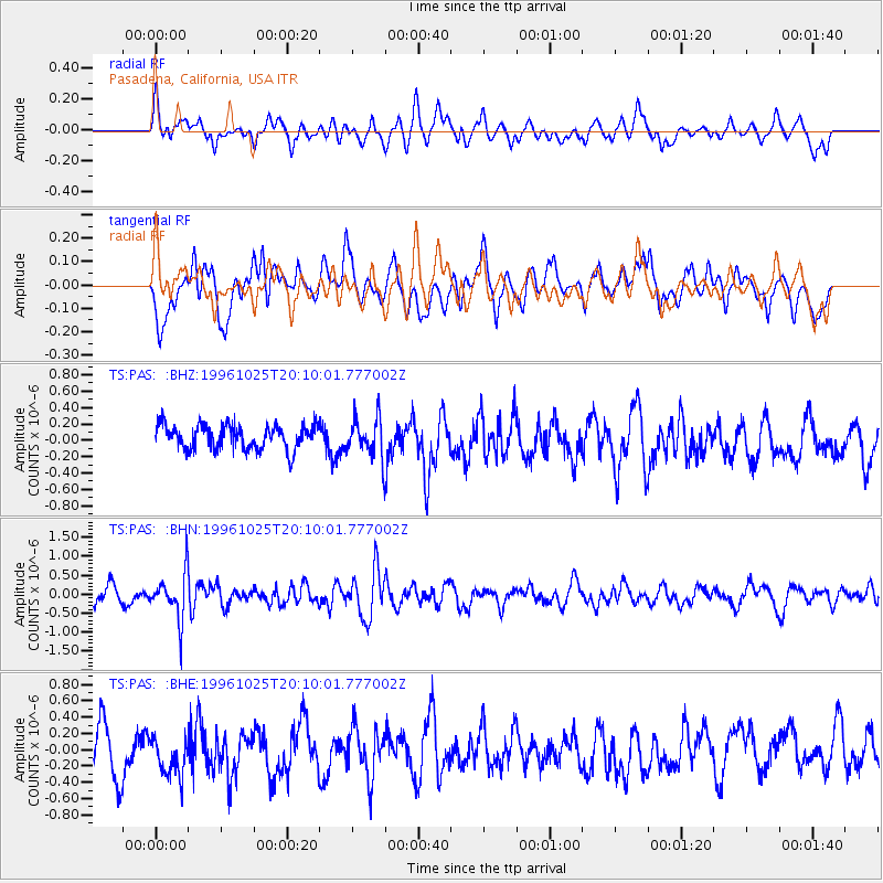
PAS Pasadena, California, USA - Earthquake Result Viewer
*The percent match for this event was below the threshold and hence no stack was calculated.
| Earthquake location: |
Peru-Bolivia Border Region |
| Earthquake latitude/longitude: |
-17.4/-70.0 |
| Earthquake time(UTC): |
1996/10/25 (299) 19:59:41 GMT |
| Earthquake Depth: |
116 km |
| Earthquake Magnitude: |
5.5 MB, 5.7 UNKNOWN, 5.6 MW |
| Earthquake Catalog/Contributor: |
WHDF/NEIC |
|
| Network: |
TS TERRAscope (Southern California Seismic Network) |
| Station: |
PAS Pasadena, California, USA |
| Lat/Lon: |
34.15 N/118.17 W |
| Elevation: |
295 m |
|
| Distance: |
68.8 deg |
| Az: |
318.463 deg |
| Baz: |
130.225 deg |
| Ray Param: |
$rayparam |
*The percent match for this event was below the threshold and hence was not used in the summary stack. |
|
| Radial Match: |
52.86431 % |
| Radial Bump: |
400 |
| Transverse Match: |
43.347256 % |
| Transverse Bump: |
400 |
| SOD ConfigId: |
4480 |
| Insert Time: |
2010-02-26 14:37:30.858 +0000 |
| GWidth: |
2.5 |
| Max Bumps: |
400 |
| Tol: |
0.001 |
|
Signal To Noise
| Channel | StoN | STA | LTA |
| TS:PAS: :BHN:19961025T20:10:01.777002Z | 3.1692688 | 6.13371E-7 | 1.9353708E-7 |
| TS:PAS: :BHE:19961025T20:10:01.777002Z | 0.91922766 | 2.831018E-7 | 3.079779E-7 |
| TS:PAS: :BHZ:19961025T20:10:01.777002Z | 1.6329001 | 2.4425495E-7 | 1.4958353E-7 |
| Arrivals |
| Ps | |
| PpPs | |
| PsPs/PpSs | |


