You are here: Home > Network List > TA - USArray Transportable Network (new EarthScope stations) Stations List
> Station F29A Eureka, SD, USA > Earthquake Result Viewer
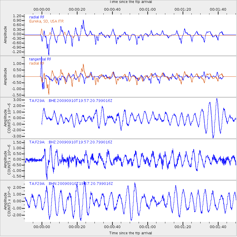
F29A Eureka, SD, USA - Earthquake Result Viewer
*The percent match for this event was below the threshold and hence no stack was calculated.
| Earthquake location: |
Easter Island Region |
| Earthquake latitude/longitude: |
-29.9/-111.8 |
| Earthquake time(UTC): |
2009/09/10 (253) 19:46:03 GMT |
| Earthquake Depth: |
10 km |
| Earthquake Magnitude: |
5.5 MW, 5.4 MB |
| Earthquake Catalog/Contributor: |
WHDF/NEIC |
|
| Network: |
TA USArray Transportable Network (new EarthScope stations) |
| Station: |
F29A Eureka, SD, USA |
| Lat/Lon: |
45.83 N/99.83 W |
| Elevation: |
575 m |
|
| Distance: |
76.2 deg |
| Az: |
8.607 deg |
| Baz: |
190.709 deg |
| Ray Param: |
$rayparam |
*The percent match for this event was below the threshold and hence was not used in the summary stack. |
|
| Radial Match: |
71.35909 % |
| Radial Bump: |
400 |
| Transverse Match: |
61.642067 % |
| Transverse Bump: |
400 |
| SOD ConfigId: |
2622 |
| Insert Time: |
2010-03-07 06:21:46.810 +0000 |
| GWidth: |
2.5 |
| Max Bumps: |
400 |
| Tol: |
0.001 |
|
Signal To Noise
| Channel | StoN | STA | LTA |
| TA:F29A: :BHZ:20090910T19:57:20.799016Z | 3.6960456 | 6.7082794E-7 | 1.8149882E-7 |
| TA:F29A: :BHN:20090910T19:57:20.799016Z | 2.1412685 | 1.30798E-6 | 6.108436E-7 |
| TA:F29A: :BHE:20090910T19:57:20.799016Z | 1.832502 | 1.1145727E-6 | 6.082245E-7 |
| Arrivals |
| Ps | |
| PpPs | |
| PsPs/PpSs | |


