You are here: Home > Network List > TA - USArray Transportable Network (new EarthScope stations) Stations List
> Station F29A Eureka, SD, USA > Earthquake Result Viewer
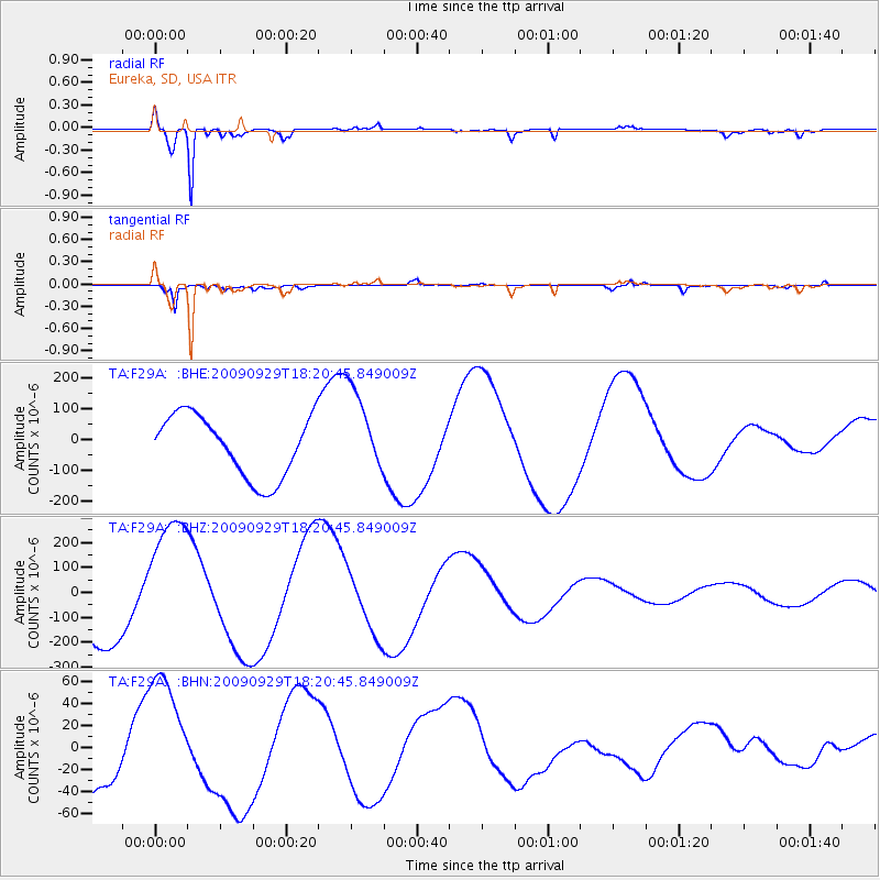
F29A Eureka, SD, USA - Earthquake Result Viewer
*The percent match for this event was below the threshold and hence no stack was calculated.
| Earthquake location: |
Samoa Islands Region |
| Earthquake latitude/longitude: |
-15.6/-172.0 |
| Earthquake time(UTC): |
2009/09/29 (272) 18:08:21 GMT |
| Earthquake Depth: |
10 km |
| Earthquake Magnitude: |
5.6 MB |
| Earthquake Catalog/Contributor: |
WHDF/NEIC |
|
| Network: |
TA USArray Transportable Network (new EarthScope stations) |
| Station: |
F29A Eureka, SD, USA |
| Lat/Lon: |
45.83 N/99.83 W |
| Elevation: |
575 m |
|
| Distance: |
89.1 deg |
| Az: |
41.737 deg |
| Baz: |
246.597 deg |
| Ray Param: |
$rayparam |
*The percent match for this event was below the threshold and hence was not used in the summary stack. |
|
| Radial Match: |
96.12217 % |
| Radial Bump: |
400 |
| Transverse Match: |
91.46313 % |
| Transverse Bump: |
400 |
| SOD ConfigId: |
2622 |
| Insert Time: |
2010-03-07 06:21:47.586 +0000 |
| GWidth: |
2.5 |
| Max Bumps: |
400 |
| Tol: |
0.001 |
|
Signal To Noise
| Channel | StoN | STA | LTA |
| TA:F29A: :BHZ:20090929T18:20:45.849009Z | 2.1418045 | 2.6818994E-4 | 1.2521681E-4 |
| TA:F29A: :BHN:20090929T18:20:45.849009Z | 2.1962779 | 5.887036E-5 | 2.6804602E-5 |
| TA:F29A: :BHE:20090929T18:20:45.849009Z | 1.3834927 | 1.3865455E-4 | 1.0022066E-4 |
| Arrivals |
| Ps | |
| PpPs | |
| PsPs/PpSs | |


