You are here: Home > Network List > TA - USArray Transportable Network (new EarthScope stations) Stations List
> Station E30A Jud, ND, USA > Earthquake Result Viewer
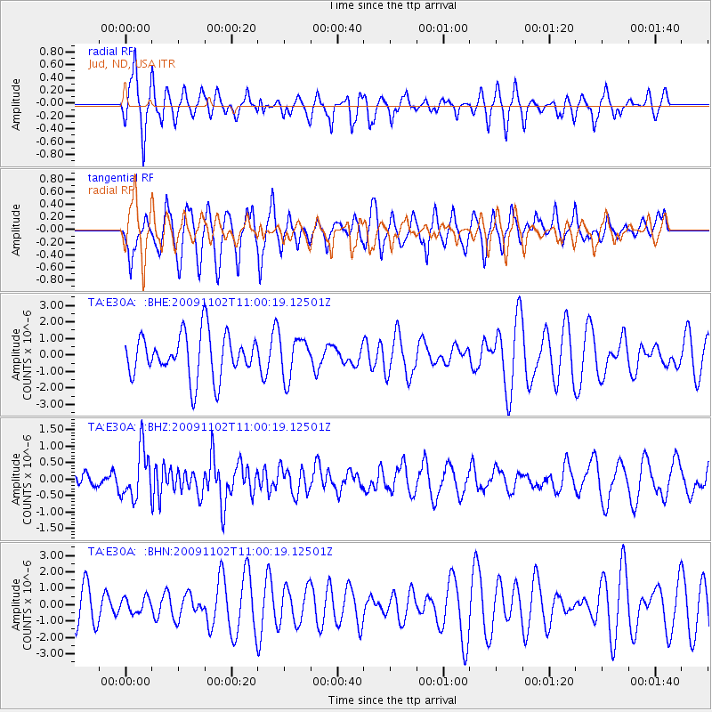
E30A Jud, ND, USA - Earthquake Result Viewer
*The percent match for this event was below the threshold and hence no stack was calculated.
| Earthquake location: |
South Of Tonga Islands |
| Earthquake latitude/longitude: |
-24.1/-175.2 |
| Earthquake time(UTC): |
2009/11/02 (306) 10:47:13 GMT |
| Earthquake Depth: |
9.0 km |
| Earthquake Magnitude: |
6.1 MB, 6.1 MS, 6.2 MW, 6.1 MW |
| Earthquake Catalog/Contributor: |
WHDF/NEIC |
|
| Network: |
TA USArray Transportable Network (new EarthScope stations) |
| Station: |
E30A Jud, ND, USA |
| Lat/Lon: |
46.50 N/98.91 W |
| Elevation: |
544 m |
|
| Distance: |
98.3 deg |
| Az: |
42.693 deg |
| Baz: |
243.755 deg |
| Ray Param: |
$rayparam |
*The percent match for this event was below the threshold and hence was not used in the summary stack. |
|
| Radial Match: |
58.97358 % |
| Radial Bump: |
359 |
| Transverse Match: |
44.43093 % |
| Transverse Bump: |
400 |
| SOD ConfigId: |
2622 |
| Insert Time: |
2010-03-07 06:22:41.715 +0000 |
| GWidth: |
2.5 |
| Max Bumps: |
400 |
| Tol: |
0.001 |
|
Signal To Noise
| Channel | StoN | STA | LTA |
| TA:E30A: :BHZ:20091102T11:00:19.12501Z | 3.0772703 | 7.5074104E-7 | 2.439633E-7 |
| TA:E30A: :BHN:20091102T11:00:19.12501Z | 0.49710703 | 4.6776162E-7 | 9.409676E-7 |
| TA:E30A: :BHE:20091102T11:00:19.12501Z | 0.9162214 | 1.207594E-6 | 1.3180155E-6 |
| Arrivals |
| Ps | |
| PpPs | |
| PsPs/PpSs | |


