You are here: Home > Network List > TA - USArray Transportable Network (new EarthScope stations) Stations List
> Station T24B San Luis, CO, USA > Earthquake Result Viewer
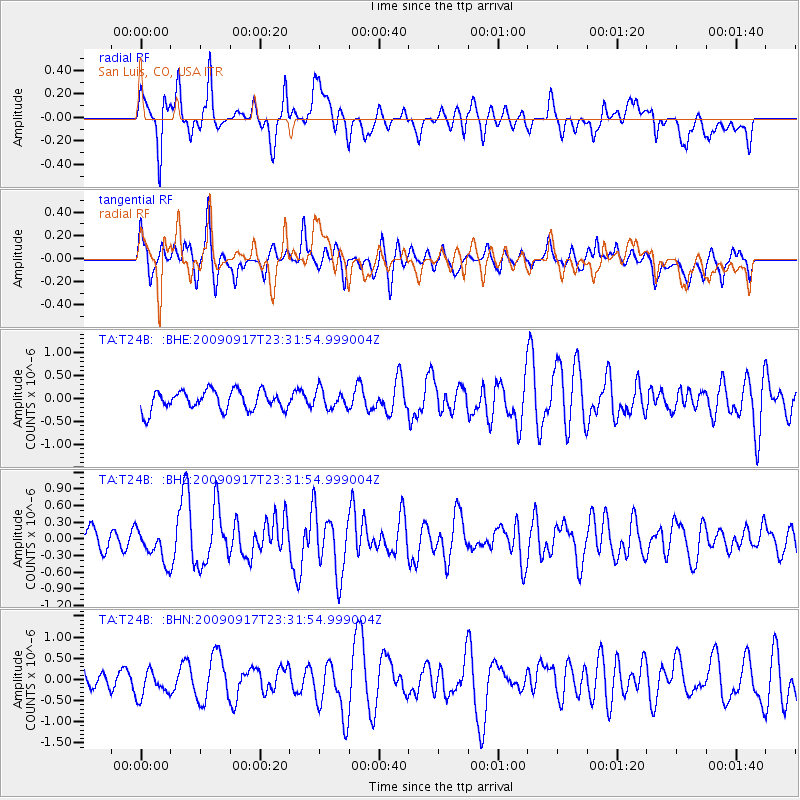
T24B San Luis, CO, USA - Earthquake Result Viewer
*The percent match for this event was below the threshold and hence no stack was calculated.
| Earthquake location: |
Easter Island Region |
| Earthquake latitude/longitude: |
-29.1/-112.3 |
| Earthquake time(UTC): |
2009/09/17 (260) 23:21:38 GMT |
| Earthquake Depth: |
10 km |
| Earthquake Magnitude: |
5.7 MB, 6.0 MS, 6.2 MW, 6.2 MW |
| Earthquake Catalog/Contributor: |
WHDF/NEIC |
|
| Network: |
TA USArray Transportable Network (new EarthScope stations) |
| Station: |
T24B San Luis, CO, USA |
| Lat/Lon: |
37.06 N/105.38 W |
| Elevation: |
2625 m |
|
| Distance: |
66.2 deg |
| Az: |
6.017 deg |
| Baz: |
186.583 deg |
| Ray Param: |
$rayparam |
*The percent match for this event was below the threshold and hence was not used in the summary stack. |
|
| Radial Match: |
69.306175 % |
| Radial Bump: |
400 |
| Transverse Match: |
67.390045 % |
| Transverse Bump: |
400 |
| SOD ConfigId: |
2622 |
| Insert Time: |
2010-03-07 06:22:54.452 +0000 |
| GWidth: |
2.5 |
| Max Bumps: |
400 |
| Tol: |
0.001 |
|
Signal To Noise
| Channel | StoN | STA | LTA |
| TA:T24B: :BHZ:20090917T23:31:54.999004Z | 1.7815113 | 2.9205407E-7 | 1.6393612E-7 |
| TA:T24B: :BHN:20090917T23:31:54.999004Z | 0.87516284 | 3.1052292E-7 | 3.548173E-7 |
| TA:T24B: :BHE:20090917T23:31:54.999004Z | 0.9464101 | 2.0181429E-7 | 2.1324189E-7 |
| Arrivals |
| Ps | |
| PpPs | |
| PsPs/PpSs | |


