You are here: Home > Network List > TA - USArray Transportable Network (new EarthScope stations) Stations List
> Station T24B San Luis, CO, USA > Earthquake Result Viewer
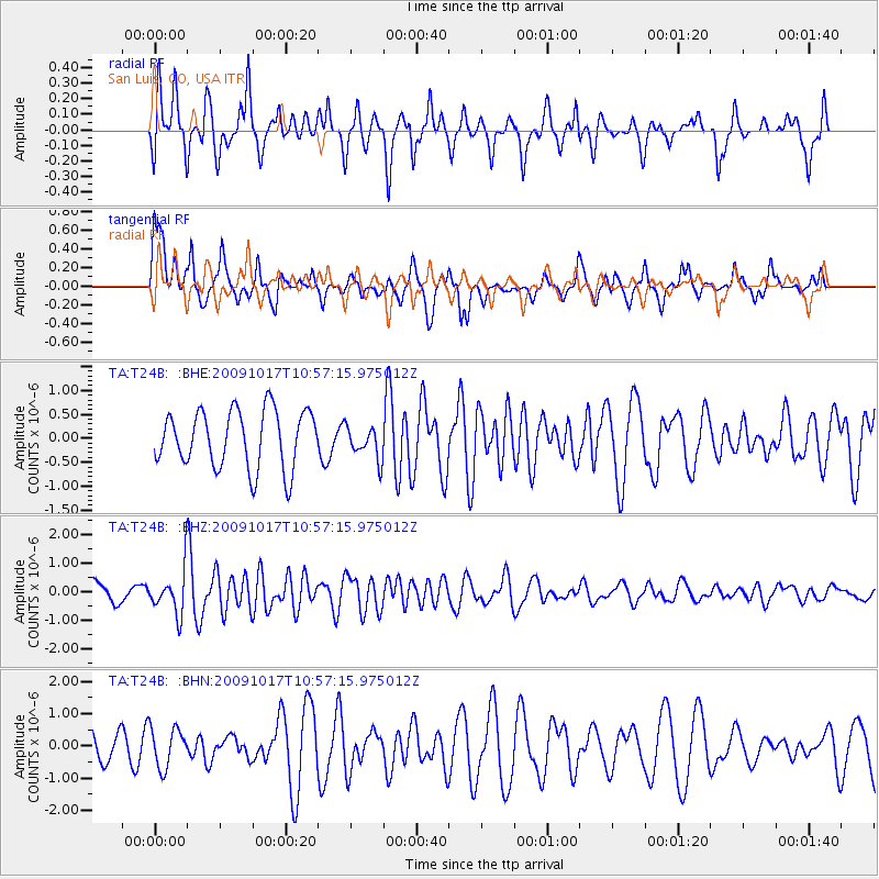
T24B San Luis, CO, USA - Earthquake Result Viewer
*The percent match for this event was below the threshold and hence no stack was calculated.
| Earthquake location: |
Samoa Islands Region |
| Earthquake latitude/longitude: |
-16.4/-172.0 |
| Earthquake time(UTC): |
2009/10/17 (290) 10:45:26 GMT |
| Earthquake Depth: |
10 km |
| Earthquake Magnitude: |
5.7 MB, 5.3 MS, 5.7 MW, 5.7 MW |
| Earthquake Catalog/Contributor: |
WHDF/NEIC |
|
| Network: |
TA USArray Transportable Network (new EarthScope stations) |
| Station: |
T24B San Luis, CO, USA |
| Lat/Lon: |
37.06 N/105.38 W |
| Elevation: |
2625 m |
|
| Distance: |
82.1 deg |
| Az: |
47.828 deg |
| Baz: |
242.804 deg |
| Ray Param: |
$rayparam |
*The percent match for this event was below the threshold and hence was not used in the summary stack. |
|
| Radial Match: |
60.57642 % |
| Radial Bump: |
400 |
| Transverse Match: |
65.317406 % |
| Transverse Bump: |
400 |
| SOD ConfigId: |
2622 |
| Insert Time: |
2010-03-07 06:23:03.349 +0000 |
| GWidth: |
2.5 |
| Max Bumps: |
400 |
| Tol: |
0.001 |
|
Signal To Noise
| Channel | StoN | STA | LTA |
| TA:T24B: :BHZ:20091017T10:57:15.975012Z | 2.564245 | 7.636539E-7 | 2.978085E-7 |
| TA:T24B: :BHN:20091017T10:57:15.975012Z | 1.1470717 | 6.1099104E-7 | 5.3265285E-7 |
| TA:T24B: :BHE:20091017T10:57:15.975012Z | 0.5629731 | 3.3743342E-7 | 5.9937753E-7 |
| Arrivals |
| Ps | |
| PpPs | |
| PsPs/PpSs | |


