You are here: Home > Network List > TS - TERRAscope (Southern California Seismic Network) Stations List
> Station PAS Pasadena, California, USA > Earthquake Result Viewer
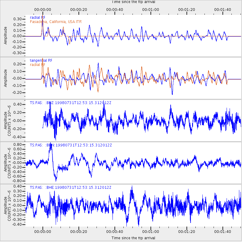
PAS Pasadena, California, USA - Earthquake Result Viewer
*The percent match for this event was below the threshold and hence no stack was calculated.
| Earthquake location: |
Southeast Of Loyalty Islands |
| Earthquake latitude/longitude: |
-21.6/169.8 |
| Earthquake time(UTC): |
1998/07/31 (212) 12:40:59 GMT |
| Earthquake Depth: |
33 km |
| Earthquake Magnitude: |
5.9 MS, 5.4 MB, 6.1 UNKNOWN, 6.0 MW |
| Earthquake Catalog/Contributor: |
WHDF/NEIC |
|
| Network: |
TS TERRAscope (Southern California Seismic Network) |
| Station: |
PAS Pasadena, California, USA |
| Lat/Lon: |
34.15 N/118.17 W |
| Elevation: |
295 m |
|
| Distance: |
88.1 deg |
| Az: |
52.114 deg |
| Baz: |
242.317 deg |
| Ray Param: |
$rayparam |
*The percent match for this event was below the threshold and hence was not used in the summary stack. |
|
| Radial Match: |
76.266335 % |
| Radial Bump: |
400 |
| Transverse Match: |
51.79494 % |
| Transverse Bump: |
400 |
| SOD ConfigId: |
4480 |
| Insert Time: |
2010-02-26 14:37:36.706 +0000 |
| GWidth: |
2.5 |
| Max Bumps: |
400 |
| Tol: |
0.001 |
|
Signal To Noise
| Channel | StoN | STA | LTA |
| TS:PAS: :BHN:19980731T12:53:15.312012Z | 3.3930895 | 3.474759E-7 | 1.0240693E-7 |
| TS:PAS: :BHE:19980731T12:53:15.312012Z | 0.92000395 | 1.09582594E-7 | 1.19111E-7 |
| TS:PAS: :BHZ:19980731T12:53:15.312012Z | 1.1425775 | 1.6127846E-7 | 1.411532E-7 |
| Arrivals |
| Ps | |
| PpPs | |
| PsPs/PpSs | |


