You are here: Home > Network List > TA - USArray Transportable Network (new EarthScope stations) Stations List
> Station M31A Lambtecht Ranch, Loup City, NE, USA > Earthquake Result Viewer
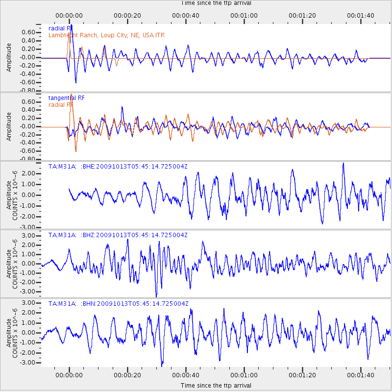
M31A Lambtecht Ranch, Loup City, NE, USA - Earthquake Result Viewer
*The percent match for this event was below the threshold and hence no stack was calculated.
| Earthquake location: |
Fox Islands, Aleutian Islands |
| Earthquake latitude/longitude: |
52.8/-167.0 |
| Earthquake time(UTC): |
2009/10/13 (286) 05:37:23 GMT |
| Earthquake Depth: |
24 km |
| Earthquake Magnitude: |
6.0 MB, 6.1 MS, 6.5 MW, 6.5 MW |
| Earthquake Catalog/Contributor: |
WHDF/NEIC |
|
| Network: |
TA USArray Transportable Network (new EarthScope stations) |
| Station: |
M31A Lambtecht Ranch, Loup City, NE, USA |
| Lat/Lon: |
41.34 N/98.98 W |
| Elevation: |
699 m |
|
| Distance: |
46.1 deg |
| Az: |
75.836 deg |
| Baz: |
308.491 deg |
| Ray Param: |
$rayparam |
*The percent match for this event was below the threshold and hence was not used in the summary stack. |
|
| Radial Match: |
73.07629 % |
| Radial Bump: |
400 |
| Transverse Match: |
65.59532 % |
| Transverse Bump: |
400 |
| SOD ConfigId: |
2622 |
| Insert Time: |
2010-03-07 06:23:46.904 +0000 |
| GWidth: |
2.5 |
| Max Bumps: |
400 |
| Tol: |
0.001 |
|
Signal To Noise
| Channel | StoN | STA | LTA |
| TA:M31A: :BHZ:20091013T05:45:14.725004Z | 3.4790998 | 7.2765573E-7 | 2.0915058E-7 |
| TA:M31A: :BHN:20091013T05:45:14.725004Z | 0.5685873 | 3.3928518E-7 | 5.9671606E-7 |
| TA:M31A: :BHE:20091013T05:45:14.725004Z | 2.0502634 | 7.5810357E-7 | 3.697591E-7 |
| Arrivals |
| Ps | |
| PpPs | |
| PsPs/PpSs | |


