You are here: Home > Network List > TA - USArray Transportable Network (new EarthScope stations) Stations List
> Station H29A Onida, SD, USA > Earthquake Result Viewer
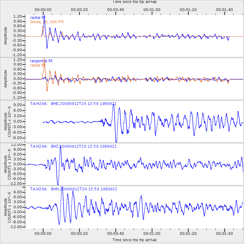
H29A Onida, SD, USA - Earthquake Result Viewer

| Earthquake location: |
Near Coast Of Venezuela |
| Earthquake latitude/longitude: |
10.7/-67.9 |
| Earthquake time(UTC): |
2009/09/12 (255) 20:06:24 GMT |
| Earthquake Depth: |
10 km |
| Earthquake Magnitude: |
6.3 MB, 6.4 MS, 6.3 MW, 6.3 MW |
| Earthquake Catalog/Contributor: |
WHDF/NEIC |
|
| Network: |
TA USArray Transportable Network (new EarthScope stations) |
| Station: |
H29A Onida, SD, USA |
| Lat/Lon: |
44.63 N/100.21 W |
| Elevation: |
548 m |
|
| Distance: |
43.7 deg |
| Az: |
326.514 deg |
| Baz: |
130.589 deg |
| Ray Param: |
0.07235436 |
| Estimated Moho Depth: |
12.25 km |
| Estimated Crust Vp/Vs: |
1.60 |
| Assumed Crust Vp: |
6.53 km/s |
| Estimated Crust Vs: |
4.082 km/s |
| Estimated Crust Poisson's Ratio: |
0.18 |
|
| Radial Match: |
93.38072 % |
| Radial Bump: |
310 |
| Transverse Match: |
79.763245 % |
| Transverse Bump: |
354 |
| SOD ConfigId: |
2622 |
| Insert Time: |
2010-03-07 06:24:16.327 +0000 |
| GWidth: |
2.5 |
| Max Bumps: |
400 |
| Tol: |
0.001 |
|
Signal To Noise
| Channel | StoN | STA | LTA |
| TA:H29A: :BHZ:20090912T20:13:59.198992Z | 11.056007 | 1.6712522E-6 | 1.5116237E-7 |
| TA:H29A: :BHN:20090912T20:13:59.198992Z | 2.2659273 | 7.373609E-7 | 3.2541243E-7 |
| TA:H29A: :BHE:20090912T20:13:59.198992Z | 2.5379252 | 8.653884E-7 | 3.409826E-7 |
| Arrivals |
| Ps | 1.2 SECOND |
| PpPs | 4.5 SECOND |
| PsPs/PpSs | 5.7 SECOND |


