H29A Onida, SD, USA - Earthquake Result Viewer
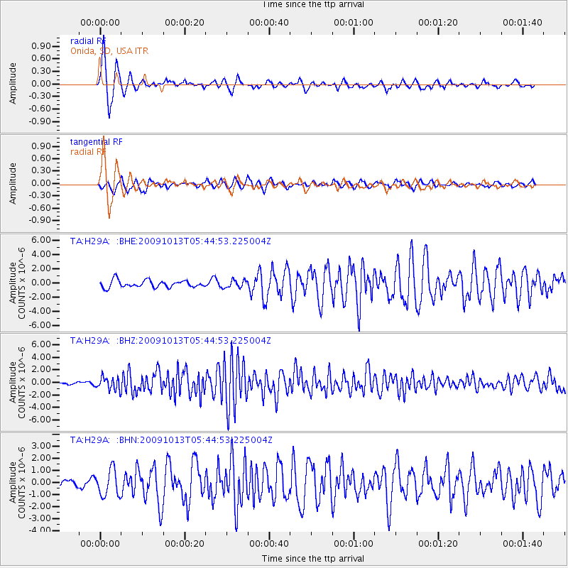
Earthquake location: Fox Islands, Aleutian Islands
Earthquake latitude/longitude: 52.8/-167.0
Earthquake time(UTC): 2009/10/13 (286) 05:37:23 GMT
Earthquake Depth: 24 km
Earthquake Magnitude: 6.0 MB, 6.1 MS, 6.5 MW, 6.5 MW
Earthquake Catalog/Contributor: WHDF/NEIC
Network: TA USArray Transportable Network (new EarthScope stations)
Station: H29A Onida, SD, USA
Lat/Lon: 44.63 N/100.21 W
Elevation: 548 m
Distance: 43.4 deg
Az: 72.89 deg
Baz: 305.557 deg
Ray Param: 0.07256071
Estimated Moho Depth: 12.5 km
Estimated Crust Vp/Vs: 1.60
Assumed Crust Vp: 6.53 km/s
Estimated Crust Vs: 4.082 km/s
Estimated Crust Poisson's Ratio: 0.18
Radial Match: 89.43935 %
Radial Bump: 365
Transverse Match: 67.503235 %
Transverse Bump: 400
SOD ConfigId: 2622
Insert Time: 2010-03-07 06:24:19.181 +0000
GWidth: 2.5
Max Bumps: 400
Tol: 0.001

Signal To Noise

ChannelStoNSTALTA
TA:H29A: :BHZ:20091013T05:44:53.225004Z4.82861769.977929E-72.0664152E-7
TA:H29A: :BHN:20091013T05:44:53.225004Z2.0852781.1010001E-65.2798714E-7
TA:H29A: :BHE:20091013T05:44:53.225004Z1.06915755.366448E-75.0193245E-7
Arrivals
Ps1.2 SECOND
PpPs4.6 SECOND
PsPs/PpSs5.9 SECOND