You are here: Home > Network List > TA - USArray Transportable Network (new EarthScope stations) Stations List
> Station O17K Koliganek, Bristol Bay, AK, USA > Earthquake Result Viewer
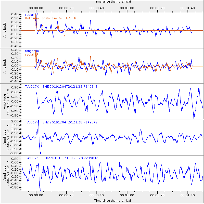
O17K Koliganek, Bristol Bay, AK, USA - Earthquake Result Viewer
*The percent match for this event was below the threshold and hence no stack was calculated.
| Earthquake location: |
Vanuatu Islands |
| Earthquake latitude/longitude: |
-19.1/169.6 |
| Earthquake time(UTC): |
2019/12/04 (338) 20:10:03 GMT |
| Earthquake Depth: |
259 km |
| Earthquake Magnitude: |
5.9 Mww |
| Earthquake Catalog/Contributor: |
NEIC PDE/us |
|
| Network: |
TA USArray Transportable Network (new EarthScope stations) |
| Station: |
O17K Koliganek, Bristol Bay, AK, USA |
| Lat/Lon: |
59.77 N/157.09 W |
| Elevation: |
156 m |
|
| Distance: |
83.1 deg |
| Az: |
16.26 deg |
| Baz: |
211.564 deg |
| Ray Param: |
$rayparam |
*The percent match for this event was below the threshold and hence was not used in the summary stack. |
|
| Radial Match: |
57.517128 % |
| Radial Bump: |
340 |
| Transverse Match: |
60.116528 % |
| Transverse Bump: |
400 |
| SOD ConfigId: |
19951751 |
| Insert Time: |
2019-12-18 20:22:12.947 +0000 |
| GWidth: |
2.5 |
| Max Bumps: |
400 |
| Tol: |
0.001 |
|
Signal To Noise
| Channel | StoN | STA | LTA |
| TA:O17K: :BHZ:20191204T20:21:28.724984Z | 3.539978 | 1.0367635E-6 | 2.9287287E-7 |
| TA:O17K: :BHN:20191204T20:21:28.724984Z | 1.7362795 | 4.7759977E-7 | 2.750708E-7 |
| TA:O17K: :BHE:20191204T20:21:28.724984Z | 0.92957574 | 3.1500744E-7 | 3.3887227E-7 |
| Arrivals |
| Ps | |
| PpPs | |
| PsPs/PpSs | |


