You are here: Home > Network List > TA - USArray Transportable Network (new EarthScope stations) Stations List
> Station R33M Jennings River, BC, CAN > Earthquake Result Viewer
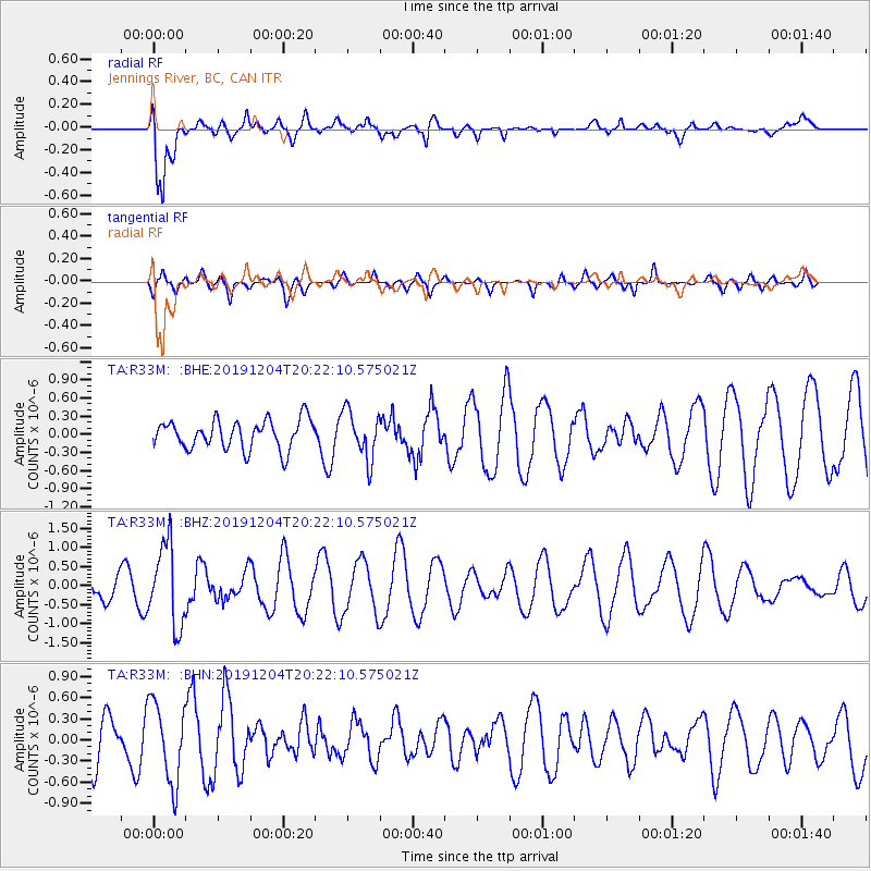
R33M Jennings River, BC, CAN - Earthquake Result Viewer
*The percent match for this event was below the threshold and hence no stack was calculated.
| Earthquake location: |
Vanuatu Islands |
| Earthquake latitude/longitude: |
-19.1/169.6 |
| Earthquake time(UTC): |
2019/12/04 (338) 20:10:03 GMT |
| Earthquake Depth: |
259 km |
| Earthquake Magnitude: |
5.9 Mww |
| Earthquake Catalog/Contributor: |
NEIC PDE/us |
|
| Network: |
TA USArray Transportable Network (new EarthScope stations) |
| Station: |
R33M Jennings River, BC, CAN |
| Lat/Lon: |
59.39 N/130.97 W |
| Elevation: |
1437 m |
|
| Distance: |
91.9 deg |
| Az: |
26.161 deg |
| Baz: |
234.591 deg |
| Ray Param: |
$rayparam |
*The percent match for this event was below the threshold and hence was not used in the summary stack. |
|
| Radial Match: |
78.79155 % |
| Radial Bump: |
400 |
| Transverse Match: |
50.75463 % |
| Transverse Bump: |
400 |
| SOD ConfigId: |
19951751 |
| Insert Time: |
2019-12-18 20:22:20.757 +0000 |
| GWidth: |
2.5 |
| Max Bumps: |
400 |
| Tol: |
0.001 |
|
Signal To Noise
| Channel | StoN | STA | LTA |
| TA:R33M: :BHZ:20191204T20:22:10.575021Z | 2.3018258 | 1.0574784E-6 | 4.5940854E-7 |
| TA:R33M: :BHN:20191204T20:22:10.575021Z | 1.7709453 | 5.6929144E-7 | 3.214619E-7 |
| TA:R33M: :BHE:20191204T20:22:10.575021Z | 1.6412272 | 3.9614704E-7 | 2.4137248E-7 |
| Arrivals |
| Ps | |
| PpPs | |
| PsPs/PpSs | |


