G30A Faulkton, SD, USA - Earthquake Result Viewer
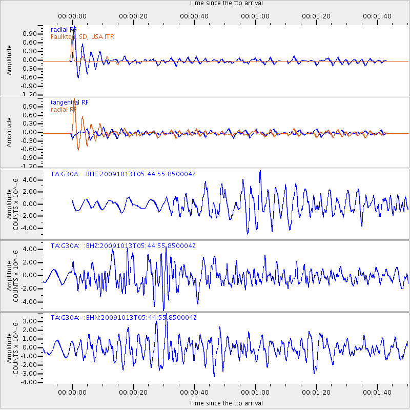
Earthquake location: Fox Islands, Aleutian Islands
Earthquake latitude/longitude: 52.8/-167.0
Earthquake time(UTC): 2009/10/13 (286) 05:37:23 GMT
Earthquake Depth: 24 km
Earthquake Magnitude: 6.0 MB, 6.1 MS, 6.5 MW, 6.5 MW
Earthquake Catalog/Contributor: WHDF/NEIC
Network: TA USArray Transportable Network (new EarthScope stations)
Station: G30A Faulkton, SD, USA
Lat/Lon: 45.13 N/99.14 W
Elevation: 496 m
Distance: 43.7 deg
Az: 71.656 deg
Baz: 305.413 deg
Ray Param: 0.072348826
Estimated Moho Depth: 10.75 km
Estimated Crust Vp/Vs: 1.60
Assumed Crust Vp: 6.53 km/s
Estimated Crust Vs: 4.082 km/s
Estimated Crust Poisson's Ratio: 0.18
Radial Match: 87.67837 %
Radial Bump: 364
Transverse Match: 67.063545 %
Transverse Bump: 398
SOD ConfigId: 2622
Insert Time: 2010-03-07 06:25:27.396 +0000
GWidth: 2.5
Max Bumps: 400
Tol: 0.001

Signal To Noise

ChannelStoNSTALTA
TA:G30A: :BHZ:20091013T05:44:55.850004Z2.21844861.0764498E-64.852264E-7
TA:G30A: :BHN:20091013T05:44:55.850004Z1.64583176.6467516E-74.0385365E-7
TA:G30A: :BHE:20091013T05:44:55.850004Z1.4421088.788033E-76.0938794E-7
Arrivals
Ps1.1 SECOND
PpPs4.0 SECOND
PsPs/PpSs5.0 SECOND