You are here: Home > Network List > TA - USArray Transportable Network (new EarthScope stations) Stations List
> Station G30A Faulkton, SD, USA > Earthquake Result Viewer
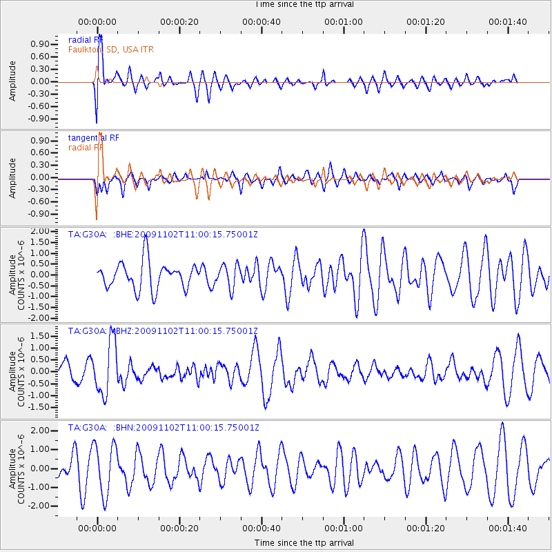
G30A Faulkton, SD, USA - Earthquake Result Viewer
*The percent match for this event was below the threshold and hence no stack was calculated.
| Earthquake location: |
South Of Tonga Islands |
| Earthquake latitude/longitude: |
-24.1/-175.2 |
| Earthquake time(UTC): |
2009/11/02 (306) 10:47:13 GMT |
| Earthquake Depth: |
9.0 km |
| Earthquake Magnitude: |
6.1 MB, 6.1 MS, 6.2 MW, 6.1 MW |
| Earthquake Catalog/Contributor: |
WHDF/NEIC |
|
| Network: |
TA USArray Transportable Network (new EarthScope stations) |
| Station: |
G30A Faulkton, SD, USA |
| Lat/Lon: |
45.13 N/99.14 W |
| Elevation: |
496 m |
|
| Distance: |
97.5 deg |
| Az: |
43.86 deg |
| Baz: |
243.427 deg |
| Ray Param: |
$rayparam |
*The percent match for this event was below the threshold and hence was not used in the summary stack. |
|
| Radial Match: |
71.70063 % |
| Radial Bump: |
400 |
| Transverse Match: |
67.83169 % |
| Transverse Bump: |
400 |
| SOD ConfigId: |
2622 |
| Insert Time: |
2010-03-07 06:25:37.766 +0000 |
| GWidth: |
2.5 |
| Max Bumps: |
400 |
| Tol: |
0.001 |
|
Signal To Noise
| Channel | StoN | STA | LTA |
| TA:G30A: :BHZ:20091102T11:00:15.75001Z | 1.9064713 | 1.1419954E-6 | 5.9901004E-7 |
| TA:G30A: :BHN:20091102T11:00:15.75001Z | 1.845501 | 1.3541168E-6 | 7.337394E-7 |
| TA:G30A: :BHE:20091102T11:00:15.75001Z | 0.8687374 | 5.418543E-7 | 6.2372624E-7 |
| Arrivals |
| Ps | |
| PpPs | |
| PsPs/PpSs | |


