You are here: Home > Network List > CN - Canadian National Seismograph Network Stations List
> Station INK INUVIK, NT > Earthquake Result Viewer
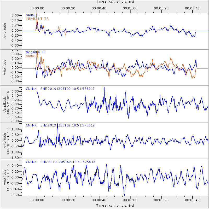
INK INUVIK, NT - Earthquake Result Viewer
*The percent match for this event was below the threshold and hence no stack was calculated.
| Earthquake location: |
Kuril Islands |
| Earthquake latitude/longitude: |
45.4/150.1 |
| Earthquake time(UTC): |
2019/12/05 (339) 02:03:18 GMT |
| Earthquake Depth: |
35 km |
| Earthquake Magnitude: |
5.6 Mww |
| Earthquake Catalog/Contributor: |
NEIC PDE/us |
|
| Network: |
CN Canadian National Seismograph Network |
| Station: |
INK INUVIK, NT |
| Lat/Lon: |
68.31 N/133.53 W |
| Elevation: |
44 m |
|
| Distance: |
43.9 deg |
| Az: |
31.414 deg |
| Baz: |
279.163 deg |
| Ray Param: |
$rayparam |
*The percent match for this event was below the threshold and hence was not used in the summary stack. |
|
| Radial Match: |
61.932686 % |
| Radial Bump: |
400 |
| Transverse Match: |
40.857292 % |
| Transverse Bump: |
400 |
| SOD ConfigId: |
19951751 |
| Insert Time: |
2019-12-19 02:12:11.683 +0000 |
| GWidth: |
2.5 |
| Max Bumps: |
400 |
| Tol: |
0.001 |
|
Signal To Noise
| Channel | StoN | STA | LTA |
| CN:INK: :BHZ:20191205T02:10:51.57501Z | 1.5168654 | 3.613369E-7 | 2.3821292E-7 |
| CN:INK: :BHN:20191205T02:10:51.57501Z | 0.9938623 | 2.403002E-7 | 2.417842E-7 |
| CN:INK: :BHE:20191205T02:10:51.57501Z | 0.9542325 | 1.7409843E-7 | 1.8244864E-7 |
| Arrivals |
| Ps | |
| PpPs | |
| PsPs/PpSs | |


