You are here: Home > Network List > TA - USArray Transportable Network (new EarthScope stations) Stations List
> Station O32A Brockman Farm, Red Cloud, NE, USA > Earthquake Result Viewer
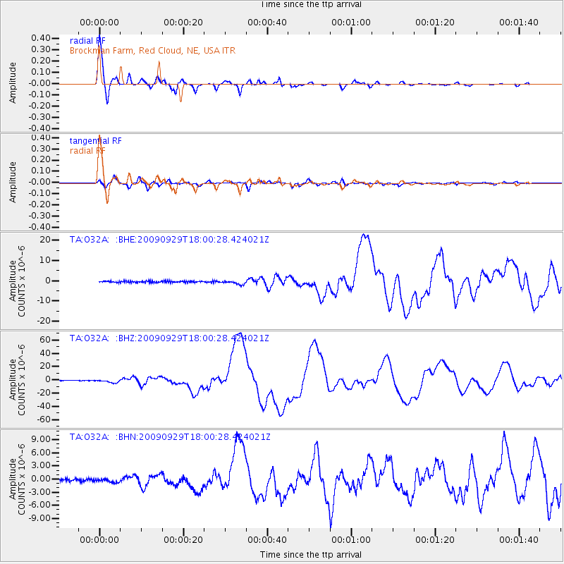
O32A Brockman Farm, Red Cloud, NE, USA - Earthquake Result Viewer

| Earthquake location: |
Samoa Islands Region |
| Earthquake latitude/longitude: |
-15.5/-172.1 |
| Earthquake time(UTC): |
2009/09/29 (272) 17:48:10 GMT |
| Earthquake Depth: |
18 km |
| Earthquake Magnitude: |
7.1 MB, 8.1 MS, 8.1 MW, 8.0 MW |
| Earthquake Catalog/Contributor: |
WHDF/NEIC |
|
| Network: |
TA USArray Transportable Network (new EarthScope stations) |
| Station: |
O32A Brockman Farm, Red Cloud, NE, USA |
| Lat/Lon: |
40.26 N/98.28 W |
| Elevation: |
579 m |
|
| Distance: |
88.0 deg |
| Az: |
47.339 deg |
| Baz: |
247.896 deg |
| Ray Param: |
0.042892743 |
| Estimated Moho Depth: |
33.5 km |
| Estimated Crust Vp/Vs: |
1.80 |
| Assumed Crust Vp: |
6.53 km/s |
| Estimated Crust Vs: |
3.623 km/s |
| Estimated Crust Poisson's Ratio: |
0.28 |
|
| Radial Match: |
98.58003 % |
| Radial Bump: |
400 |
| Transverse Match: |
87.60819 % |
| Transverse Bump: |
400 |
| SOD ConfigId: |
2622 |
| Insert Time: |
2010-03-07 06:25:45.731 +0000 |
| GWidth: |
2.5 |
| Max Bumps: |
400 |
| Tol: |
0.001 |
|
Signal To Noise
| Channel | StoN | STA | LTA |
| TA:O32A: :BHZ:20090929T18:00:28.424021Z | 10.183857 | 2.1759517E-6 | 2.1366675E-7 |
| TA:O32A: :BHN:20090929T18:00:28.424021Z | 1.6844486 | 4.403216E-7 | 2.61404E-7 |
| TA:O32A: :BHE:20090929T18:00:28.424021Z | 2.8167958 | 8.969481E-7 | 3.184285E-7 |
| Arrivals |
| Ps | 4.2 SECOND |
| PpPs | 14 SECOND |
| PsPs/PpSs | 18 SECOND |


