You are here: Home > Network List > US - United States National Seismic Network Stations List
> Station DGMT Dagmar, Montana, USA > Earthquake Result Viewer
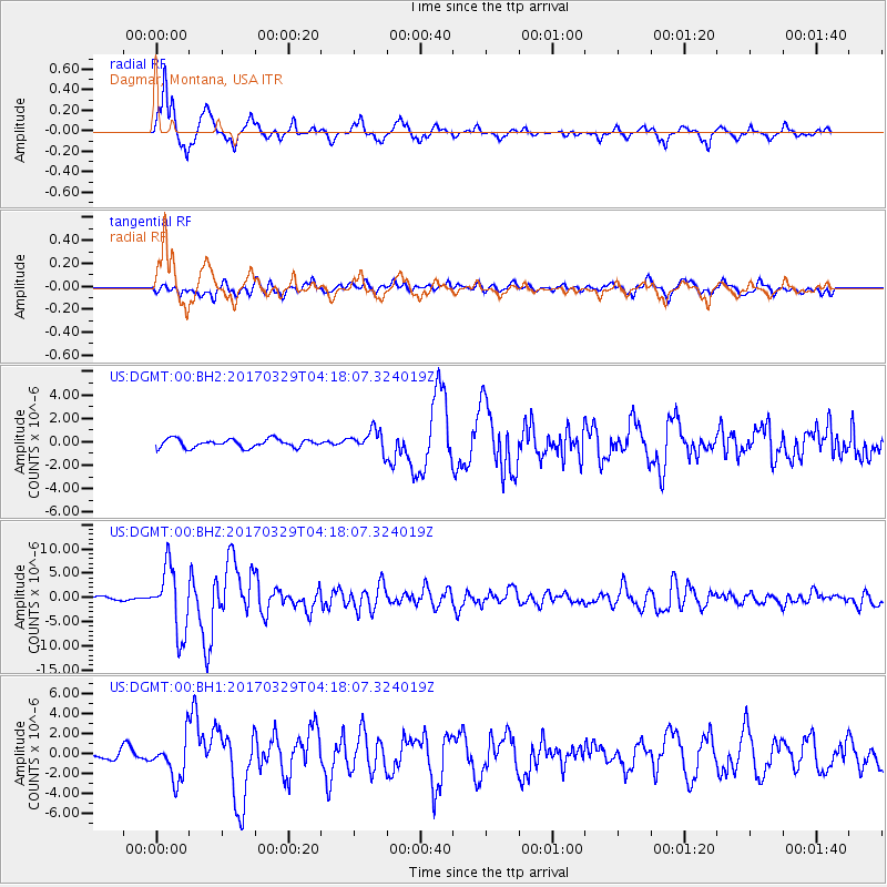
DGMT Dagmar, Montana, USA - Earthquake Result Viewer
*The percent match for this event was below the threshold and hence no stack was calculated.
| Earthquake location: |
Near East Coast Of Kamchatka |
| Earthquake latitude/longitude: |
56.9/162.7 |
| Earthquake time(UTC): |
2017/03/29 (088) 04:09:24 GMT |
| Earthquake Depth: |
23 km |
| Earthquake Magnitude: |
6.6 Mww |
| Earthquake Catalog/Contributor: |
NEIC PDE/us |
|
| Network: |
US United States National Seismic Network |
| Station: |
DGMT Dagmar, Montana, USA |
| Lat/Lon: |
48.47 N/104.20 W |
| Elevation: |
0.0 m |
|
| Distance: |
52.8 deg |
| Az: |
56.544 deg |
| Baz: |
316.569 deg |
| Ray Param: |
$rayparam |
*The percent match for this event was below the threshold and hence was not used in the summary stack. |
|
| Radial Match: |
90.82643 % |
| Radial Bump: |
310 |
| Transverse Match: |
70.71318 % |
| Transverse Bump: |
400 |
| SOD ConfigId: |
2028011 |
| Insert Time: |
2017-04-12 04:17:44.159 +0000 |
| GWidth: |
2.5 |
| Max Bumps: |
400 |
| Tol: |
0.001 |
|
Signal To Noise
| Channel | StoN | STA | LTA |
| US:DGMT:00:BHZ:20170329T04:18:07.324019Z | 20.62502 | 6.6499297E-6 | 3.2242053E-7 |
| US:DGMT:00:BH1:20170329T04:18:07.324019Z | 3.1154227 | 2.0555913E-6 | 6.598114E-7 |
| US:DGMT:00:BH2:20170329T04:18:07.324019Z | 2.578272 | 9.200774E-7 | 3.5685818E-7 |
| Arrivals |
| Ps | |
| PpPs | |
| PsPs/PpSs | |


