K30A Basset, NE, USA - Earthquake Result Viewer
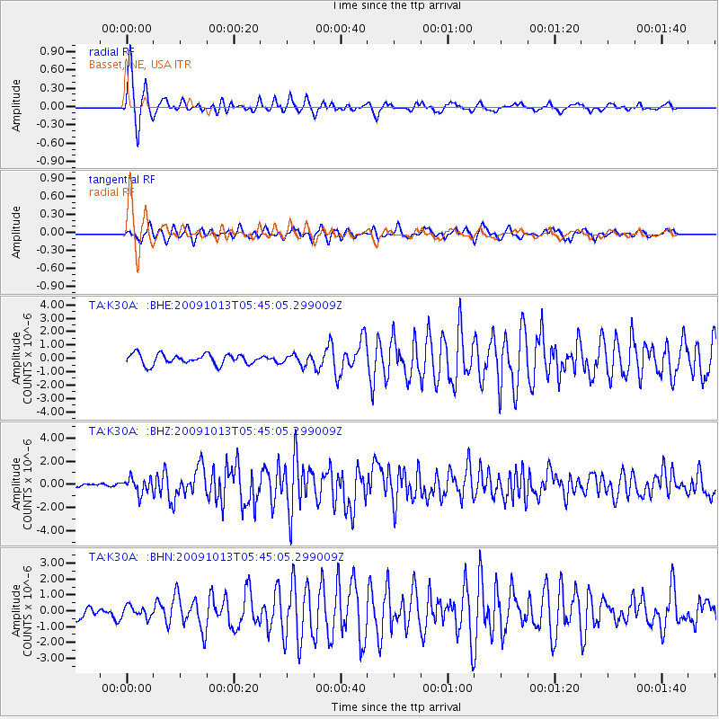
Earthquake location: Fox Islands, Aleutian Islands
Earthquake latitude/longitude: 52.8/-167.0
Earthquake time(UTC): 2009/10/13 (286) 05:37:23 GMT
Earthquake Depth: 24 km
Earthquake Magnitude: 6.0 MB, 6.1 MS, 6.5 MW, 6.5 MW
Earthquake Catalog/Contributor: WHDF/NEIC
Network: TA USArray Transportable Network (new EarthScope stations)
Station: K30A Basset, NE, USA
Lat/Lon: 42.67 N/99.61 W
Elevation: 712 m
Distance: 44.9 deg
Az: 74.774 deg
Baz: 307.322 deg
Ray Param: 0.07161117
Estimated Moho Depth: 10.25 km
Estimated Crust Vp/Vs: 1.60
Assumed Crust Vp: 6.53 km/s
Estimated Crust Vs: 4.082 km/s
Estimated Crust Poisson's Ratio: 0.18
Radial Match: 91.159836 %
Radial Bump: 382
Transverse Match: 75.05136 %
Transverse Bump: 400
SOD ConfigId: 2622
Insert Time: 2010-03-07 06:26:08.225 +0000
GWidth: 2.5
Max Bumps: 400
Tol: 0.001

Signal To Noise

ChannelStoNSTALTA
TA:K30A: :BHZ:20091013T05:45:05.299009Z2.73492316.6949815E-72.4479598E-7
TA:K30A: :BHN:20091013T05:45:05.299009Z0.84970073.4525465E-74.0632503E-7
TA:K30A: :BHE:20091013T05:45:05.299009Z0.96928133.6954398E-73.8125566E-7
Arrivals
Ps1.0 SECOND
PpPs3.8 SECOND
PsPs/PpSs4.8 SECOND