You are here: Home > Network List > TA - USArray Transportable Network (new EarthScope stations) Stations List
> Station R33M Jennings River, BC, CAN > Earthquake Result Viewer
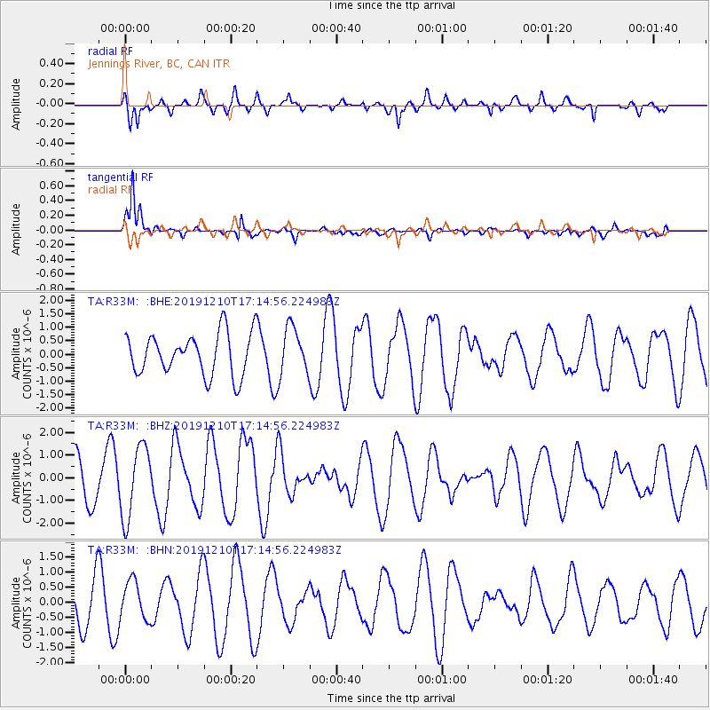
R33M Jennings River, BC, CAN - Earthquake Result Viewer
*The percent match for this event was below the threshold and hence no stack was calculated.
| Earthquake location: |
Southeast Of Honshu, Japan |
| Earthquake latitude/longitude: |
30.7/141.7 |
| Earthquake time(UTC): |
2019/12/10 (344) 17:05:02 GMT |
| Earthquake Depth: |
14 km |
| Earthquake Magnitude: |
5.9 Mww |
| Earthquake Catalog/Contributor: |
NEIC PDE/us |
|
| Network: |
TA USArray Transportable Network (new EarthScope stations) |
| Station: |
R33M Jennings River, BC, CAN |
| Lat/Lon: |
59.39 N/130.97 W |
| Elevation: |
1437 m |
|
| Distance: |
62.8 deg |
| Az: |
35.083 deg |
| Baz: |
284.668 deg |
| Ray Param: |
$rayparam |
*The percent match for this event was below the threshold and hence was not used in the summary stack. |
|
| Radial Match: |
70.68689 % |
| Radial Bump: |
400 |
| Transverse Match: |
89.25591 % |
| Transverse Bump: |
368 |
| SOD ConfigId: |
20358551 |
| Insert Time: |
2019-12-24 17:19:25.173 +0000 |
| GWidth: |
2.5 |
| Max Bumps: |
400 |
| Tol: |
0.001 |
|
Signal To Noise
| Channel | StoN | STA | LTA |
| TA:R33M: :BHZ:20191210T17:14:56.224983Z | 1.819294 | 1.5921248E-6 | 8.7513337E-7 |
| TA:R33M: :BHN:20191210T17:14:56.224983Z | 1.2261447 | 6.3551283E-7 | 5.1830165E-7 |
| TA:R33M: :BHE:20191210T17:14:56.224983Z | 1.1336554 | 8.707806E-7 | 7.681175E-7 |
| Arrivals |
| Ps | |
| PpPs | |
| PsPs/PpSs | |


