You are here: Home > Network List > US - United States National Seismic Network Stations List
> Station WMOK Wichita Mountains, Oklahoma, USA > Earthquake Result Viewer
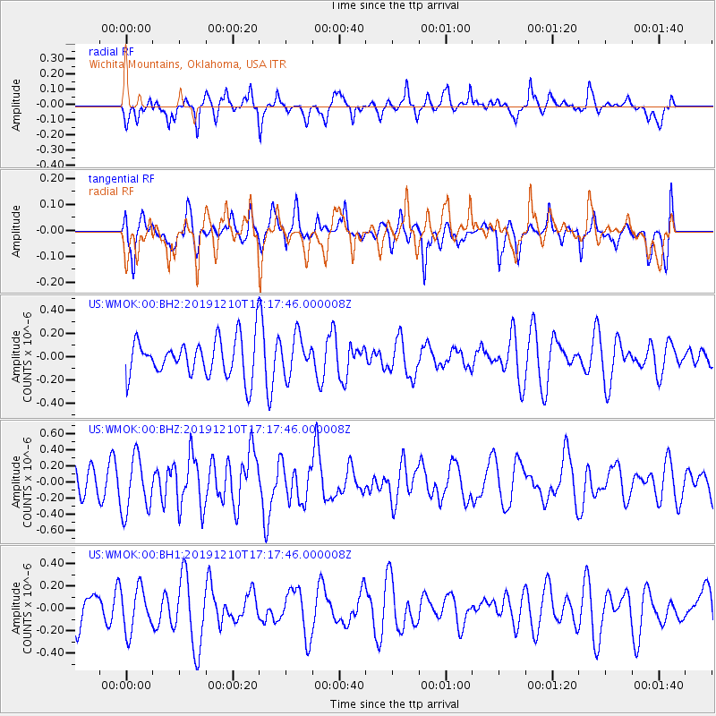
WMOK Wichita Mountains, Oklahoma, USA - Earthquake Result Viewer
*The percent match for this event was below the threshold and hence no stack was calculated.
| Earthquake location: |
Southeast Of Honshu, Japan |
| Earthquake latitude/longitude: |
30.7/141.7 |
| Earthquake time(UTC): |
2019/12/10 (344) 17:05:02 GMT |
| Earthquake Depth: |
14 km |
| Earthquake Magnitude: |
5.9 Mww |
| Earthquake Catalog/Contributor: |
NEIC PDE/us |
|
| Network: |
US United States National Seismic Network |
| Station: |
WMOK Wichita Mountains, Oklahoma, USA |
| Lat/Lon: |
34.74 N/98.78 W |
| Elevation: |
486 m |
|
| Distance: |
93.5 deg |
| Az: |
45.909 deg |
| Baz: |
311.318 deg |
| Ray Param: |
$rayparam |
*The percent match for this event was below the threshold and hence was not used in the summary stack. |
|
| Radial Match: |
63.133194 % |
| Radial Bump: |
400 |
| Transverse Match: |
52.39467 % |
| Transverse Bump: |
400 |
| SOD ConfigId: |
20358551 |
| Insert Time: |
2019-12-24 17:20:03.040 +0000 |
| GWidth: |
2.5 |
| Max Bumps: |
400 |
| Tol: |
0.001 |
|
Signal To Noise
| Channel | StoN | STA | LTA |
| US:WMOK:00:BHZ:20191210T17:17:46.000008Z | 1.9160038 | 3.4717067E-7 | 1.8119519E-7 |
| US:WMOK:00:BH1:20191210T17:17:46.000008Z | 1.4306897 | 1.9219958E-7 | 1.343405E-7 |
| US:WMOK:00:BH2:20191210T17:17:46.000008Z | 1.008245 | 1.638696E-7 | 1.6252955E-7 |
| Arrivals |
| Ps | |
| PpPs | |
| PsPs/PpSs | |


