You are here: Home > Network List > CN - Canadian National Seismograph Network Stations List
> Station INK INUVIK, NT > Earthquake Result Viewer
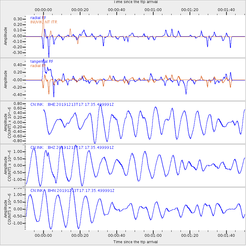
INK INUVIK, NT - Earthquake Result Viewer
*The percent match for this event was below the threshold and hence no stack was calculated.
| Earthquake location: |
Halmahera, Indonesia |
| Earthquake latitude/longitude: |
-0.9/127.9 |
| Earthquake time(UTC): |
2019/12/13 (347) 17:04:50 GMT |
| Earthquake Depth: |
22 km |
| Earthquake Magnitude: |
5.3 Mww |
| Earthquake Catalog/Contributor: |
NEIC PDE/us |
|
| Network: |
CN Canadian National Seismograph Network |
| Station: |
INK INUVIK, NT |
| Lat/Lon: |
68.31 N/133.53 W |
| Elevation: |
44 m |
|
| Distance: |
94.0 deg |
| Az: |
21.627 deg |
| Baz: |
277.615 deg |
| Ray Param: |
$rayparam |
*The percent match for this event was below the threshold and hence was not used in the summary stack. |
|
| Radial Match: |
63.231483 % |
| Radial Bump: |
400 |
| Transverse Match: |
84.208435 % |
| Transverse Bump: |
400 |
| SOD ConfigId: |
20358551 |
| Insert Time: |
2019-12-27 17:16:12.721 +0000 |
| GWidth: |
2.5 |
| Max Bumps: |
400 |
| Tol: |
0.001 |
|
Signal To Noise
| Channel | StoN | STA | LTA |
| CN:INK: :BHZ:20191213T17:17:35.499991Z | 0.9027013 | 7.1478337E-7 | 7.918271E-7 |
| CN:INK: :BHN:20191213T17:17:35.499991Z | 1.4903111 | 1.0462372E-6 | 7.02026E-7 |
| CN:INK: :BHE:20191213T17:17:35.499991Z | 2.1242495 | 5.230126E-7 | 2.4621053E-7 |
| Arrivals |
| Ps | |
| PpPs | |
| PsPs/PpSs | |


