You are here: Home > Network List > MN - MEDNET Project Stations List
> Station AQU L'Aquila, Italy > Earthquake Result Viewer
AQU L'Aquila, Italy - Earthquake Result Viewer

| Earthquake location: |
Northern India |
| Earthquake latitude/longitude: |
30.7/78.8 |
| Earthquake time(UTC): |
1991/10/19 (292) 21:23:15 GMT |
| Earthquake Depth: |
19 km |
| Earthquake Magnitude: |
6.5 MB, 7.1 MS |
| Earthquake Catalog/Contributor: |
WHDF/NEIC |
|
| Network: |
MN MEDNET Project |
| Station: |
AQU L'Aquila, Italy |
| Lat/Lon: |
42.35 N/13.40 E |
| Elevation: |
710 m |
|
| Distance: |
52.6 deg |
| Az: |
301.99 deg |
| Baz: |
80.124 deg |
| Ray Param: |
0.066625334 |
| Estimated Moho Depth: |
33.75 km |
| Estimated Crust Vp/Vs: |
2.04 |
| Assumed Crust Vp: |
6.276 km/s |
| Estimated Crust Vs: |
3.08 km/s |
| Estimated Crust Poisson's Ratio: |
0.34 |
|
| Radial Match: |
87.37855 % |
| Radial Bump: |
400 |
| Transverse Match: |
85.91021 % |
| Transverse Bump: |
400 |
| SOD ConfigId: |
16938 |
| Insert Time: |
2010-03-08 16:33:00.969 +0000 |
| GWidth: |
2.5 |
| Max Bumps: |
400 |
| Tol: |
0.001 |
|
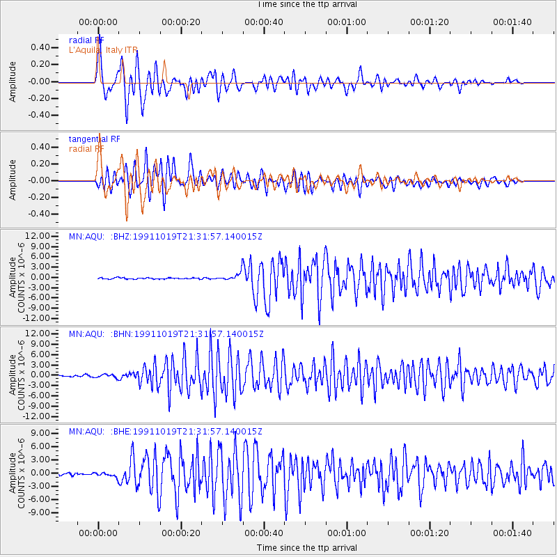
Signal To Noise
| Channel | StoN | STA | LTA |
| MN:AQU: :BHN:19911019T21:31:57.140015Z | 2.2820969 | 5.169735E-7 | 2.2653442E-7 |
| MN:AQU: :BHE:19911019T21:31:57.140015Z | 2.2071495 | 5.638067E-7 | 2.554456E-7 |
| MN:AQU: :BHZ:19911019T21:31:57.140015Z | 7.830117 | 1.3522033E-6 | 1.726926E-7 |
| Arrivals |
| Ps | 5.8 SECOND |
| PpPs | 16 SECOND |
| PsPs/PpSs | 21 SECOND |


