You are here: Home > Network List > G - GEOSCOPE Stations List
> Station NOUC Port Laguerre, New Caledonia > Earthquake Result Viewer
NOUC Port Laguerre, New Caledonia - Earthquake Result Viewer
*The percent match for this event was below the threshold and hence no stack was calculated.
| Earthquake location: |
Minahassa Peninsula, Sulawesi |
| Earthquake latitude/longitude: |
0.3/120.6 |
| Earthquake time(UTC): |
2017/03/31 (090) 11:21:00 GMT |
| Earthquake Depth: |
93 km |
| Earthquake Magnitude: |
5.6 mb |
| Earthquake Catalog/Contributor: |
NEIC PDE/us |
|
| Network: |
G GEOSCOPE |
| Station: |
NOUC Port Laguerre, New Caledonia |
| Lat/Lon: |
22.10 S/166.30 E |
| Elevation: |
112 m |
|
| Distance: |
49.8 deg |
| Az: |
119.658 deg |
| Baz: |
290.445 deg |
| Ray Param: |
$rayparam |
*The percent match for this event was below the threshold and hence was not used in the summary stack. |
|
| Radial Match: |
62.958076 % |
| Radial Bump: |
400 |
| Transverse Match: |
66.92114 % |
| Transverse Bump: |
400 |
| SOD ConfigId: |
2028011 |
| Insert Time: |
2017-04-14 11:25:46.745 +0000 |
| GWidth: |
2.5 |
| Max Bumps: |
400 |
| Tol: |
0.001 |
|
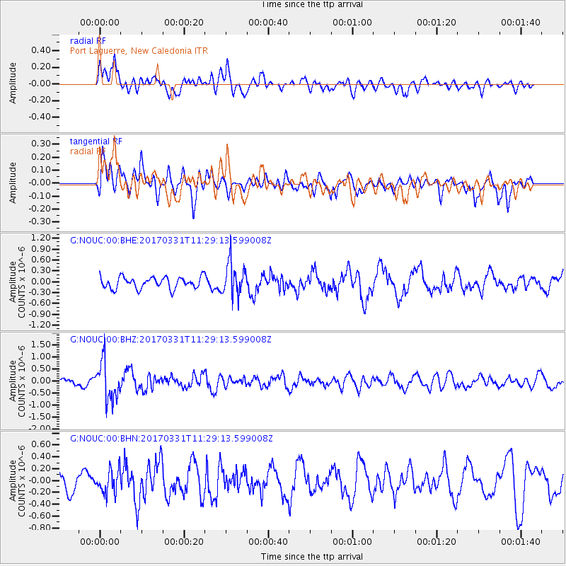
Signal To Noise
| Channel | StoN | STA | LTA |
| G:NOUC:00:BHZ:20170331T11:29:13.599008Z | 6.9676785 | 8.1733305E-7 | 1.1730349E-7 |
| G:NOUC:00:BHN:20170331T11:29:13.599008Z | 1.0992836 | 2.0012298E-7 | 1.8204854E-7 |
| G:NOUC:00:BHE:20170331T11:29:13.599008Z | 2.8736527 | 4.5463293E-7 | 1.5820733E-7 |
| Arrivals |
| Ps | |
| PpPs | |
| PsPs/PpSs | |


