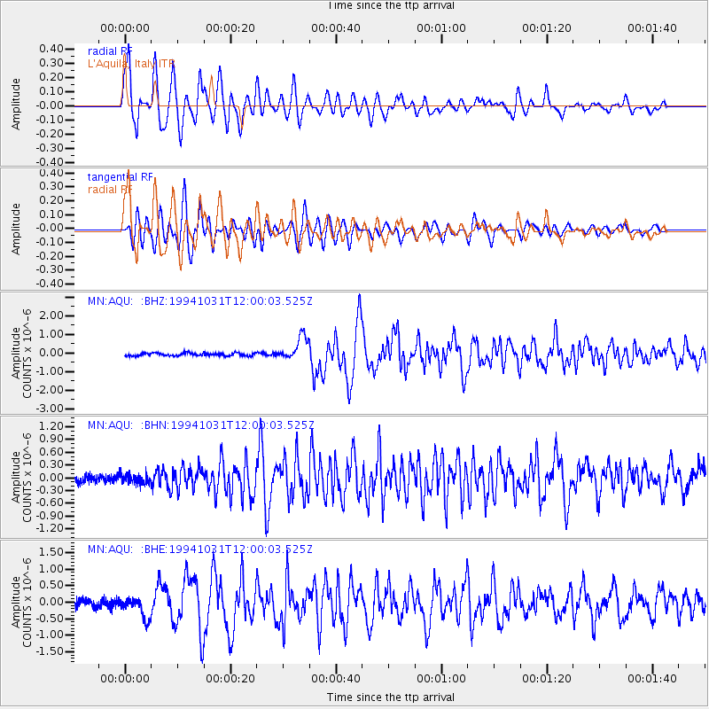
AQU L'Aquila, Italy - Earthquake Result Viewer
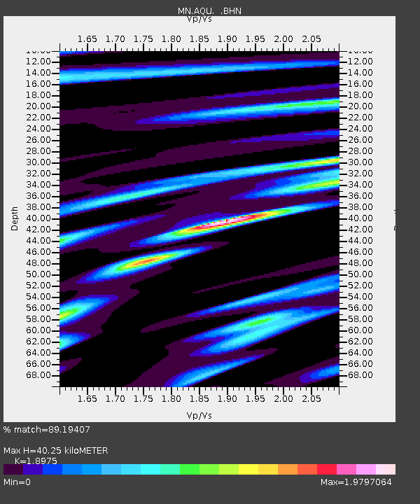
Earthquake location: Northern Sumatra, Indonesia
Earthquake latitude/longitude: 3.0/96.3
Earthquake time(UTC): 1994/10/31 (304) 11:48:15 GMT
Earthquake Depth: 46 km
Earthquake Magnitude: 5.6 MB, 6.1 MS, 6.3 UNKNOWN, 6.2 MW
Earthquake Catalog/Contributor: WHDF/NEIC
Network: MN MEDNET Project
Station: AQU L'Aquila, Italy
Lat/Lon: 42.35 N/13.40 E
Elevation: 710 m
Distance: 82.7 deg
Az: 312.138 deg
Baz: 92.562 deg
Ray Param: 0.04663714
Estimated Moho Depth: 40.25 km
Estimated Crust Vp/Vs: 1.90
Assumed Crust Vp: 6.276 km/s
Estimated Crust Vs: 3.307 km/s
Estimated Crust Poisson's Ratio: 0.31
Radial Match: 89.19407 %
Radial Bump: 400
Transverse Match: 90.56066 %
Transverse Bump: 400
SOD ConfigId: 17000
Insert Time: 2010-03-08 16:34:21.497 +0000
GWidth: 2.5
Max Bumps: 400
Tol: 0.001

Signal To Noise

ChannelStoNSTALTA
MN:AQU: :BHN:19941031T12:00:03.525Z0.917216661.1043645E-71.204039E-7
MN:AQU: :BHE:19941031T12:00:03.525Z2.3156813.098699E-71.3381373E-7
MN:AQU: :BHZ:19941031T12:00:03.525Z8.3688646.371443E-77.6132714E-8
Arrivals
Ps5.9 SECOND
PpPs18 SECOND
PsPs/PpSs24 SECOND