You are here: Home > Network List > TA - USArray Transportable Network (new EarthScope stations) Stations List
> Station I17K Unalakleet, AK, USA > Earthquake Result Viewer
I17K Unalakleet, AK, USA - Earthquake Result Viewer
*The percent match for this event was below the threshold and hence no stack was calculated.
| Earthquake location: |
Vanuatu Islands |
| Earthquake latitude/longitude: |
-14.4/167.7 |
| Earthquake time(UTC): |
2019/12/14 (348) 04:57:37 GMT |
| Earthquake Depth: |
27 km |
| Earthquake Magnitude: |
5.9 Mww |
| Earthquake Catalog/Contributor: |
NEIC PDE/us |
|
| Network: |
TA USArray Transportable Network (new EarthScope stations) |
| Station: |
I17K Unalakleet, AK, USA |
| Lat/Lon: |
63.89 N/160.70 W |
| Elevation: |
105 m |
|
| Distance: |
81.8 deg |
| Az: |
13.557 deg |
| Baz: |
210.878 deg |
| Ray Param: |
$rayparam |
*The percent match for this event was below the threshold and hence was not used in the summary stack. |
|
| Radial Match: |
77.68697 % |
| Radial Bump: |
400 |
| Transverse Match: |
68.10969 % |
| Transverse Bump: |
400 |
| SOD ConfigId: |
20358551 |
| Insert Time: |
2019-12-28 05:12:42.342 +0000 |
| GWidth: |
2.5 |
| Max Bumps: |
400 |
| Tol: |
0.001 |
|
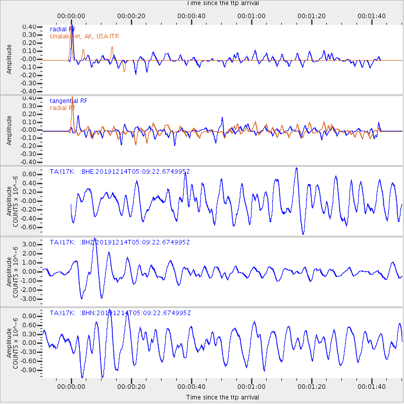
Signal To Noise
| Channel | StoN | STA | LTA |
| TA:I17K: :BHZ:20191214T05:09:22.674995Z | 7.4567165 | 1.5334207E-6 | 2.0564288E-7 |
| TA:I17K: :BHN:20191214T05:09:22.674995Z | 2.474108 | 5.4518677E-7 | 2.2035691E-7 |
| TA:I17K: :BHE:20191214T05:09:22.674995Z | 0.79389244 | 1.8257238E-7 | 2.2997116E-7 |
| Arrivals |
| Ps | |
| PpPs | |
| PsPs/PpSs | |


