You are here: Home > Network List > G - GEOSCOPE Stations List
> Station MPG Montagne des Peres, French Guyana > Earthquake Result Viewer
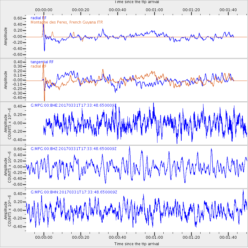
MPG Montagne des Peres, French Guyana - Earthquake Result Viewer
*The percent match for this event was below the threshold and hence no stack was calculated.
| Earthquake location: |
Reykjanes Ridge |
| Earthquake latitude/longitude: |
52.7/-32.3 |
| Earthquake time(UTC): |
2017/03/31 (090) 17:25:23 GMT |
| Earthquake Depth: |
10 km |
| Earthquake Magnitude: |
5.5 Mww |
| Earthquake Catalog/Contributor: |
NEIC PDE/us |
|
| Network: |
G GEOSCOPE |
| Station: |
MPG Montagne des Peres, French Guyana |
| Lat/Lon: |
5.11 N/52.64 W |
| Elevation: |
147 m |
|
| Distance: |
50.3 deg |
| Az: |
206.738 deg |
| Baz: |
15.965 deg |
| Ray Param: |
$rayparam |
*The percent match for this event was below the threshold and hence was not used in the summary stack. |
|
| Radial Match: |
55.597992 % |
| Radial Bump: |
400 |
| Transverse Match: |
54.368088 % |
| Transverse Bump: |
400 |
| SOD ConfigId: |
2028011 |
| Insert Time: |
2017-04-14 17:27:26.445 +0000 |
| GWidth: |
2.5 |
| Max Bumps: |
400 |
| Tol: |
0.001 |
|
Signal To Noise
| Channel | StoN | STA | LTA |
| G:MPG:00:BHZ:20170331T17:33:48.650009Z | 1.4630489 | 2.224219E-7 | 1.5202629E-7 |
| G:MPG:00:BHN:20170331T17:33:48.650009Z | 1.0164734 | 1.8089575E-7 | 1.7796407E-7 |
| G:MPG:00:BHE:20170331T17:33:48.650009Z | 1.198084 | 1.4828562E-7 | 1.2376897E-7 |
| Arrivals |
| Ps | |
| PpPs | |
| PsPs/PpSs | |


