You are here: Home > Network List > GS - US Geological Survey Networks Stations List
> Station KAN08 Pence Farm, Harper, KS, USA > Earthquake Result Viewer
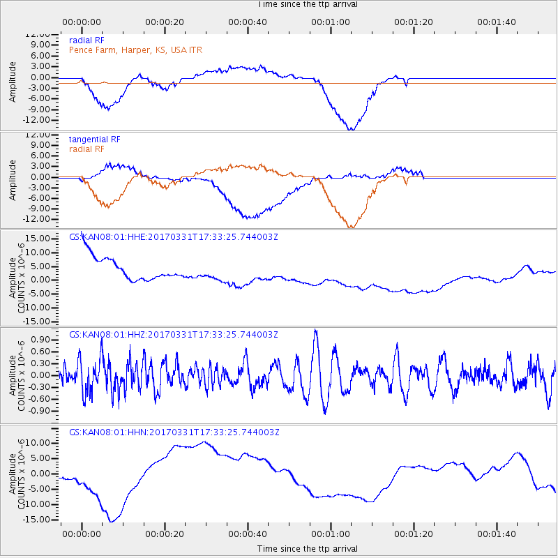
KAN08 Pence Farm, Harper, KS, USA - Earthquake Result Viewer
*The percent match for this event was below the threshold and hence no stack was calculated.
| Earthquake location: |
Reykjanes Ridge |
| Earthquake latitude/longitude: |
52.7/-32.3 |
| Earthquake time(UTC): |
2017/03/31 (090) 17:25:23 GMT |
| Earthquake Depth: |
10 km |
| Earthquake Magnitude: |
5.5 Mww |
| Earthquake Catalog/Contributor: |
NEIC PDE/us |
|
| Network: |
GS US Geological Survey Networks |
| Station: |
KAN08 Pence Farm, Harper, KS, USA |
| Lat/Lon: |
37.23 N/97.97 W |
| Elevation: |
375 m |
|
| Distance: |
47.3 deg |
| Az: |
278.282 deg |
| Baz: |
49.02 deg |
| Ray Param: |
$rayparam |
*The percent match for this event was below the threshold and hence was not used in the summary stack. |
|
| Radial Match: |
58.189495 % |
| Radial Bump: |
400 |
| Transverse Match: |
45.56348 % |
| Transverse Bump: |
400 |
| SOD ConfigId: |
2028011 |
| Insert Time: |
2017-04-14 17:27:54.202 +0000 |
| GWidth: |
2.5 |
| Max Bumps: |
400 |
| Tol: |
0.001 |
|
Signal To Noise
| Channel | StoN | STA | LTA |
| GS:KAN08:01:HHZ:20170331T17:33:25.744003Z | 1.8321742 | 4.3153779E-7 | 2.3553316E-7 |
| GS:KAN08:01:HHN:20170331T17:33:25.744003Z | 1.8072217 | 3.951716E-6 | 2.186625E-6 |
| GS:KAN08:01:HHE:20170331T17:33:25.744003Z | 0.8252643 | 3.4986433E-6 | 4.2394217E-6 |
| Arrivals |
| Ps | |
| PpPs | |
| PsPs/PpSs | |


