You are here: Home > Network List > TA - USArray Transportable Network (new EarthScope stations) Stations List
> Station F21K Alatna River, AK, USA > Earthquake Result Viewer
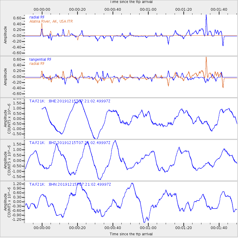
F21K Alatna River, AK, USA - Earthquake Result Viewer
*The percent match for this event was below the threshold and hence no stack was calculated.
| Earthquake location: |
Mindanao, Philippines |
| Earthquake latitude/longitude: |
6.5/125.3 |
| Earthquake time(UTC): |
2019/12/15 (349) 07:09:21 GMT |
| Earthquake Depth: |
10 km |
| Earthquake Magnitude: |
5.7 mb |
| Earthquake Catalog/Contributor: |
NEIC PDE/us |
|
| Network: |
TA USArray Transportable Network (new EarthScope stations) |
| Station: |
F21K Alatna River, AK, USA |
| Lat/Lon: |
67.22 N/153.48 W |
| Elevation: |
597 m |
|
| Distance: |
80.6 deg |
| Az: |
22.956 deg |
| Baz: |
264.43 deg |
| Ray Param: |
$rayparam |
*The percent match for this event was below the threshold and hence was not used in the summary stack. |
|
| Radial Match: |
42.426292 % |
| Radial Bump: |
381 |
| Transverse Match: |
24.653687 % |
| Transverse Bump: |
328 |
| SOD ConfigId: |
20358551 |
| Insert Time: |
2019-12-29 07:20:27.529 +0000 |
| GWidth: |
2.5 |
| Max Bumps: |
400 |
| Tol: |
0.001 |
|
Signal To Noise
| Channel | StoN | STA | LTA |
| TA:F21K: :BHZ:20191215T07:21:02.49997Z | 0.952782 | 4.965367E-7 | 5.211441E-7 |
| TA:F21K: :BHN:20191215T07:21:02.49997Z | 0.34204358 | 3.5890287E-7 | 1.04929E-6 |
| TA:F21K: :BHE:20191215T07:21:02.49997Z | 1.6763327 | 1.7801743E-6 | 1.0619458E-6 |
| Arrivals |
| Ps | |
| PpPs | |
| PsPs/PpSs | |


