You are here: Home > Network List > TS - TERRAscope (Southern California Seismic Network) Stations List
> Station PAS Pasadena, California, USA > Earthquake Result Viewer
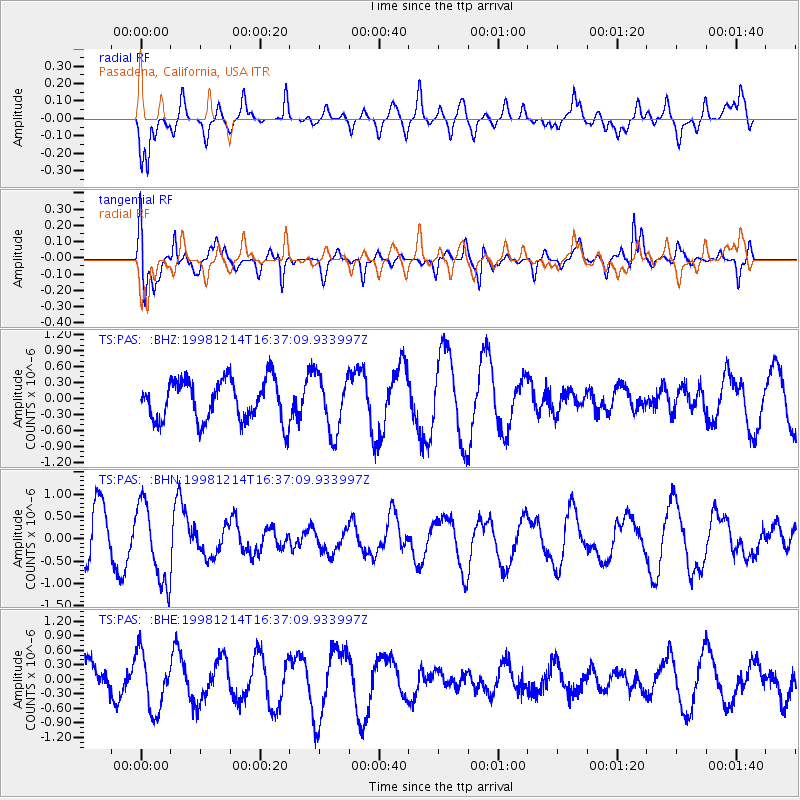
PAS Pasadena, California, USA - Earthquake Result Viewer
*The percent match for this event was below the threshold and hence no stack was calculated.
| Earthquake location: |
S. Chile-Argentina Border Region |
| Earthquake latitude/longitude: |
-38.2/-71.0 |
| Earthquake time(UTC): |
1998/12/14 (348) 16:25:24 GMT |
| Earthquake Depth: |
138 km |
| Earthquake Magnitude: |
6.0 UNKNOWN, 4.8 MS, 5.4 MB |
| Earthquake Catalog/Contributor: |
WHDF/NEIC |
|
| Network: |
TS TERRAscope (Southern California Seismic Network) |
| Station: |
PAS Pasadena, California, USA |
| Lat/Lon: |
34.15 N/118.17 W |
| Elevation: |
295 m |
|
| Distance: |
84.3 deg |
| Az: |
322.34 deg |
| Baz: |
144.527 deg |
| Ray Param: |
$rayparam |
*The percent match for this event was below the threshold and hence was not used in the summary stack. |
|
| Radial Match: |
50.22041 % |
| Radial Bump: |
400 |
| Transverse Match: |
67.78694 % |
| Transverse Bump: |
381 |
| SOD ConfigId: |
4480 |
| Insert Time: |
2010-02-26 14:38:13.341 +0000 |
| GWidth: |
2.5 |
| Max Bumps: |
400 |
| Tol: |
0.001 |
|
Signal To Noise
| Channel | StoN | STA | LTA |
| TS:PAS: :BHN:19981214T16:37:09.933997Z | 1.9029582 | 8.8367597E-7 | 4.643696E-7 |
| TS:PAS: :BHE:19981214T16:37:09.933997Z | 1.2727386 | 5.8113596E-7 | 4.566028E-7 |
| TS:PAS: :BHZ:19981214T16:37:09.933997Z | 1.3868434 | 5.355629E-7 | 3.86174E-7 |
| Arrivals |
| Ps | |
| PpPs | |
| PsPs/PpSs | |


