You are here: Home > Network List > US - United States National Seismic Network Stations List
> Station BOZ Bozeman, Montana, USA > Earthquake Result Viewer
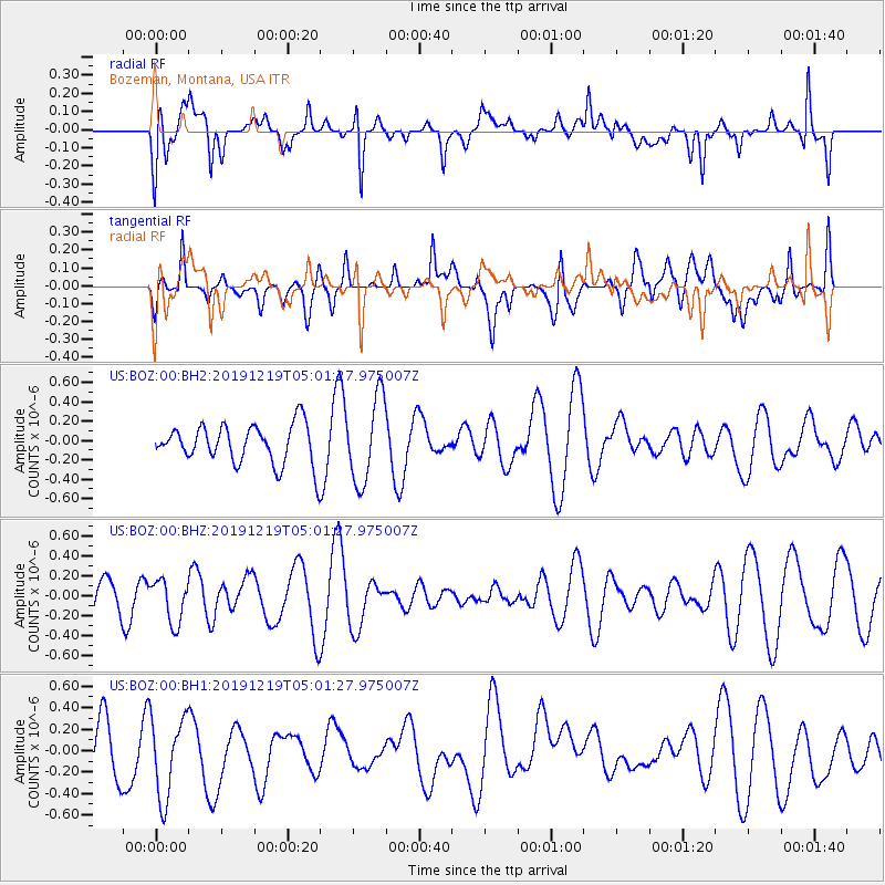
BOZ Bozeman, Montana, USA - Earthquake Result Viewer
*The percent match for this event was below the threshold and hence no stack was calculated.
| Earthquake location: |
South Of Fiji Islands |
| Earthquake latitude/longitude: |
-26.3/178.4 |
| Earthquake time(UTC): |
2019/12/19 (353) 04:49:39 GMT |
| Earthquake Depth: |
624 km |
| Earthquake Magnitude: |
5.5 Mww |
| Earthquake Catalog/Contributor: |
NEIC PDE/us |
|
| Network: |
US United States National Seismic Network |
| Station: |
BOZ Bozeman, Montana, USA |
| Lat/Lon: |
45.65 N/111.63 W |
| Elevation: |
1589 m |
|
| Distance: |
95.6 deg |
| Az: |
41.479 deg |
| Baz: |
237.959 deg |
| Ray Param: |
$rayparam |
*The percent match for this event was below the threshold and hence was not used in the summary stack. |
|
| Radial Match: |
39.81283 % |
| Radial Bump: |
400 |
| Transverse Match: |
44.695454 % |
| Transverse Bump: |
400 |
| SOD ConfigId: |
20358551 |
| Insert Time: |
2020-01-02 05:02:23.290 +0000 |
| GWidth: |
2.5 |
| Max Bumps: |
400 |
| Tol: |
0.001 |
|
Signal To Noise
| Channel | StoN | STA | LTA |
| US:BOZ:00:BHZ:20191219T05:01:27.975007Z | 1.1622031 | 2.188674E-7 | 1.8832114E-7 |
| US:BOZ:00:BH1:20191219T05:01:27.975007Z | 1.5935819 | 3.8366264E-7 | 2.407549E-7 |
| US:BOZ:00:BH2:20191219T05:01:27.975007Z | 2.1340046 | 4.3921798E-7 | 2.0581867E-7 |
| Arrivals |
| Ps | |
| PpPs | |
| PsPs/PpSs | |


