You are here: Home > Network List > US - United States National Seismic Network Stations List
> Station HAWA Hanford, Washington, USA > Earthquake Result Viewer
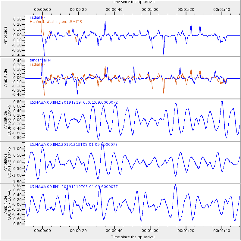
HAWA Hanford, Washington, USA - Earthquake Result Viewer
*The percent match for this event was below the threshold and hence no stack was calculated.
| Earthquake location: |
South Of Fiji Islands |
| Earthquake latitude/longitude: |
-26.3/178.4 |
| Earthquake time(UTC): |
2019/12/19 (353) 04:49:39 GMT |
| Earthquake Depth: |
624 km |
| Earthquake Magnitude: |
5.5 Mww |
| Earthquake Catalog/Contributor: |
NEIC PDE/us |
|
| Network: |
US United States National Seismic Network |
| Station: |
HAWA Hanford, Washington, USA |
| Lat/Lon: |
46.39 N/119.53 W |
| Elevation: |
364 m |
|
| Distance: |
91.6 deg |
| Az: |
37.722 deg |
| Baz: |
232.523 deg |
| Ray Param: |
$rayparam |
*The percent match for this event was below the threshold and hence was not used in the summary stack. |
|
| Radial Match: |
74.524345 % |
| Radial Bump: |
394 |
| Transverse Match: |
59.46713 % |
| Transverse Bump: |
400 |
| SOD ConfigId: |
20358551 |
| Insert Time: |
2020-01-02 05:02:24.869 +0000 |
| GWidth: |
2.5 |
| Max Bumps: |
400 |
| Tol: |
0.001 |
|
Signal To Noise
| Channel | StoN | STA | LTA |
| US:HAWA:00:BHZ:20191219T05:01:09.600007Z | 1.5957745 | 6.1845066E-7 | 3.875552E-7 |
| US:HAWA:00:BH1:20191219T05:01:09.600007Z | 0.88495994 | 2.5637954E-7 | 2.8970751E-7 |
| US:HAWA:00:BH2:20191219T05:01:09.600007Z | 2.1410837 | 5.2284224E-7 | 2.4419515E-7 |
| Arrivals |
| Ps | |
| PpPs | |
| PsPs/PpSs | |


