You are here: Home > Network List > US - United States National Seismic Network Stations List
> Station AMTX Amarillo, Texas, USA > Earthquake Result Viewer
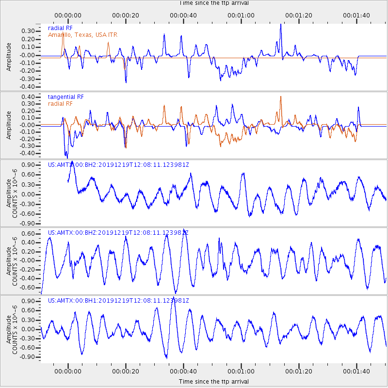
AMTX Amarillo, Texas, USA - Earthquake Result Viewer
*The percent match for this event was below the threshold and hence no stack was calculated.
| Earthquake location: |
Mariana Islands |
| Earthquake latitude/longitude: |
18.6/145.6 |
| Earthquake time(UTC): |
2019/12/19 (353) 11:55:32 GMT |
| Earthquake Depth: |
187 km |
| Earthquake Magnitude: |
5.6 Mww |
| Earthquake Catalog/Contributor: |
NEIC PDE/us |
|
| Network: |
US United States National Seismic Network |
| Station: |
AMTX Amarillo, Texas, USA |
| Lat/Lon: |
34.53 N/101.41 W |
| Elevation: |
1010 m |
|
| Distance: |
97.3 deg |
| Az: |
50.025 deg |
| Baz: |
298.289 deg |
| Ray Param: |
$rayparam |
*The percent match for this event was below the threshold and hence was not used in the summary stack. |
|
| Radial Match: |
55.317604 % |
| Radial Bump: |
400 |
| Transverse Match: |
64.25852 % |
| Transverse Bump: |
400 |
| SOD ConfigId: |
20358551 |
| Insert Time: |
2020-01-02 12:06:51.444 +0000 |
| GWidth: |
2.5 |
| Max Bumps: |
400 |
| Tol: |
0.001 |
|
Signal To Noise
| Channel | StoN | STA | LTA |
| US:AMTX:00:BHZ:20191219T12:08:11.123981Z | 0.37016892 | 1.9846982E-7 | 5.3616014E-7 |
| US:AMTX:00:BH1:20191219T12:08:11.123981Z | 1.6207055 | 3.8042467E-7 | 2.3472784E-7 |
| US:AMTX:00:BH2:20191219T12:08:11.123981Z | 0.7827245 | 2.13674E-7 | 2.7298748E-7 |
| Arrivals |
| Ps | |
| PpPs | |
| PsPs/PpSs | |


