You are here: Home > Network List > AZ - ANZA Regional Network Stations List
> Station FRD AZ.FRD > Earthquake Result Viewer
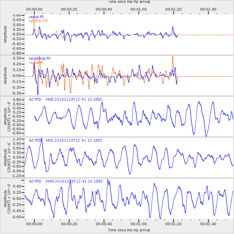
FRD AZ.FRD - Earthquake Result Viewer
*The percent match for this event was below the threshold and hence no stack was calculated.
| Earthquake location: |
Near Coast Of Guatemala |
| Earthquake latitude/longitude: |
13.7/-91.3 |
| Earthquake time(UTC): |
2019/12/19 (353) 12:35:32 GMT |
| Earthquake Depth: |
31 km |
| Earthquake Magnitude: |
5.9 Mww |
| Earthquake Catalog/Contributor: |
NEIC PDE/us |
|
| Network: |
AZ ANZA Regional Network |
| Station: |
FRD AZ.FRD |
| Lat/Lon: |
33.49 N/116.60 W |
| Elevation: |
1164 m |
|
| Distance: |
30.3 deg |
| Az: |
314.938 deg |
| Baz: |
124.579 deg |
| Ray Param: |
$rayparam |
*The percent match for this event was below the threshold and hence was not used in the summary stack. |
|
| Radial Match: |
56.8063 % |
| Radial Bump: |
400 |
| Transverse Match: |
53.98652 % |
| Transverse Bump: |
400 |
| SOD ConfigId: |
20358551 |
| Insert Time: |
2020-01-02 12:44:04.499 +0000 |
| GWidth: |
2.5 |
| Max Bumps: |
400 |
| Tol: |
0.001 |
|
Signal To Noise
| Channel | StoN | STA | LTA |
| AZ:FRD: :HHZ:20191219T12:41:10.188Z | 1.8044538 | 6.659101E-7 | 3.6903688E-7 |
| AZ:FRD: :HHN:20191219T12:41:10.188Z | 0.7511493 | 1.4791961E-7 | 1.9692439E-7 |
| AZ:FRD: :HHE:20191219T12:41:10.188Z | 1.5263519 | 3.556108E-7 | 2.3298088E-7 |
| Arrivals |
| Ps | |
| PpPs | |
| PsPs/PpSs | |


