You are here: Home > Network List > TA - USArray Transportable Network (new EarthScope stations) Stations List
> Station F20K Avaraart Lake, AK, USA > Earthquake Result Viewer
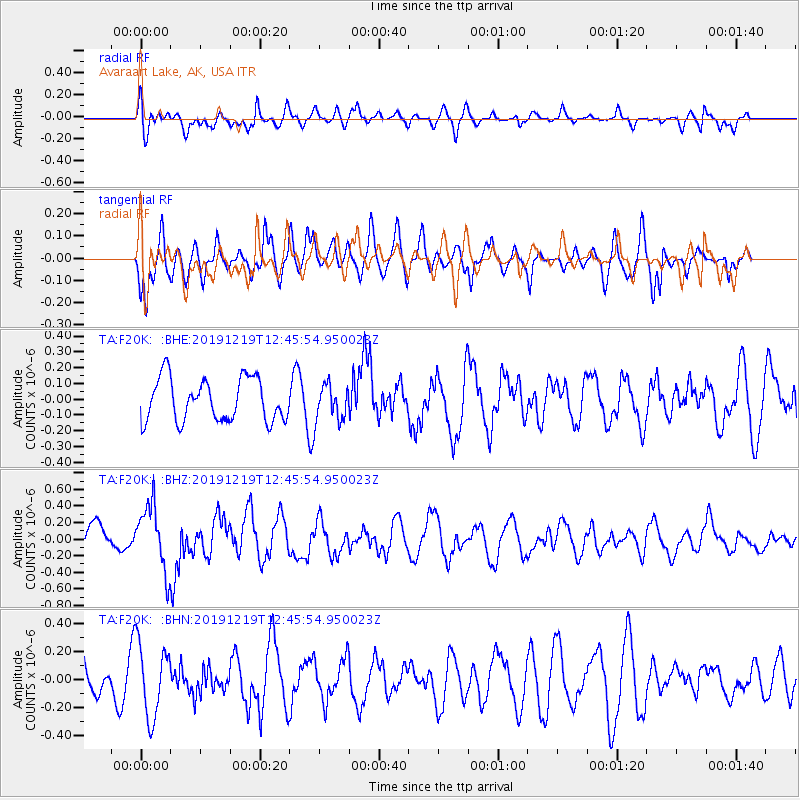
F20K Avaraart Lake, AK, USA - Earthquake Result Viewer
*The percent match for this event was below the threshold and hence no stack was calculated.
| Earthquake location: |
Near Coast Of Guatemala |
| Earthquake latitude/longitude: |
13.7/-91.3 |
| Earthquake time(UTC): |
2019/12/19 (353) 12:35:32 GMT |
| Earthquake Depth: |
31 km |
| Earthquake Magnitude: |
5.9 Mww |
| Earthquake Catalog/Contributor: |
NEIC PDE/us |
|
| Network: |
TA USArray Transportable Network (new EarthScope stations) |
| Station: |
F20K Avaraart Lake, AK, USA |
| Lat/Lon: |
67.05 N/155.73 W |
| Elevation: |
136 m |
|
| Distance: |
67.6 deg |
| Az: |
337.508 deg |
| Baz: |
108.537 deg |
| Ray Param: |
$rayparam |
*The percent match for this event was below the threshold and hence was not used in the summary stack. |
|
| Radial Match: |
49.400547 % |
| Radial Bump: |
400 |
| Transverse Match: |
65.265366 % |
| Transverse Bump: |
400 |
| SOD ConfigId: |
20358551 |
| Insert Time: |
2020-01-02 12:47:40.702 +0000 |
| GWidth: |
2.5 |
| Max Bumps: |
400 |
| Tol: |
0.001 |
|
Signal To Noise
| Channel | StoN | STA | LTA |
| TA:F20K: :BHZ:20191219T12:45:54.950023Z | 1.6479017 | 3.9039242E-7 | 2.3690275E-7 |
| TA:F20K: :BHN:20191219T12:45:54.950023Z | 1.6022958 | 2.5980233E-7 | 1.6214382E-7 |
| TA:F20K: :BHE:20191219T12:45:54.950023Z | 0.8577317 | 1.1577177E-7 | 1.3497434E-7 |
| Arrivals |
| Ps | |
| PpPs | |
| PsPs/PpSs | |


