You are here: Home > Network List > TA - USArray Transportable Network (new EarthScope stations) Stations List
> Station L15K Ungalak Mountain, AK, USA > Earthquake Result Viewer
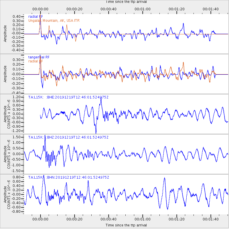
L15K Ungalak Mountain, AK, USA - Earthquake Result Viewer
*The percent match for this event was below the threshold and hence no stack was calculated.
| Earthquake location: |
Near Coast Of Guatemala |
| Earthquake latitude/longitude: |
13.7/-91.3 |
| Earthquake time(UTC): |
2019/12/19 (353) 12:35:32 GMT |
| Earthquake Depth: |
31 km |
| Earthquake Magnitude: |
5.9 Mww |
| Earthquake Catalog/Contributor: |
NEIC PDE/us |
|
| Network: |
TA USArray Transportable Network (new EarthScope stations) |
| Station: |
L15K Ungalak Mountain, AK, USA |
| Lat/Lon: |
61.68 N/161.49 W |
| Elevation: |
219 m |
|
| Distance: |
68.7 deg |
| Az: |
331.206 deg |
| Baz: |
100.993 deg |
| Ray Param: |
$rayparam |
*The percent match for this event was below the threshold and hence was not used in the summary stack. |
|
| Radial Match: |
55.398277 % |
| Radial Bump: |
400 |
| Transverse Match: |
52.962086 % |
| Transverse Bump: |
400 |
| SOD ConfigId: |
20358551 |
| Insert Time: |
2020-01-02 12:47:50.618 +0000 |
| GWidth: |
2.5 |
| Max Bumps: |
400 |
| Tol: |
0.001 |
|
Signal To Noise
| Channel | StoN | STA | LTA |
| TA:L15K: :BHZ:20191219T12:46:01.524975Z | 1.8862901 | 5.7228294E-7 | 3.0339072E-7 |
| TA:L15K: :BHN:20191219T12:46:01.524975Z | 1.8425643 | 4.5113657E-7 | 2.448417E-7 |
| TA:L15K: :BHE:20191219T12:46:01.524975Z | 2.4005823 | 5.49744E-7 | 2.2900444E-7 |
| Arrivals |
| Ps | |
| PpPs | |
| PsPs/PpSs | |


