You are here: Home > Network List > TS - TERRAscope (Southern California Seismic Network) Stations List
> Station PAS Pasadena, California, USA > Earthquake Result Viewer
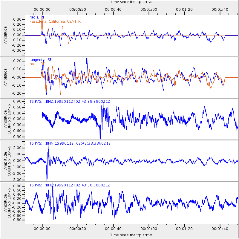
PAS Pasadena, California, USA - Earthquake Result Viewer
*The percent match for this event was below the threshold and hence no stack was calculated.
| Earthquake location: |
Bonin Islands, Japan Region |
| Earthquake latitude/longitude: |
26.7/140.2 |
| Earthquake time(UTC): |
1999/01/12 (012) 02:32:25 GMT |
| Earthquake Depth: |
441 km |
| Earthquake Magnitude: |
5.9 MB, 6.1 MW, 5.9 MW |
| Earthquake Catalog/Contributor: |
WHDF/NEIC |
|
| Network: |
TS TERRAscope (Southern California Seismic Network) |
| Station: |
PAS Pasadena, California, USA |
| Lat/Lon: |
34.15 N/118.17 W |
| Elevation: |
295 m |
|
| Distance: |
84.2 deg |
| Az: |
54.719 deg |
| Baz: |
298.329 deg |
| Ray Param: |
$rayparam |
*The percent match for this event was below the threshold and hence was not used in the summary stack. |
|
| Radial Match: |
43.06129 % |
| Radial Bump: |
400 |
| Transverse Match: |
74.56938 % |
| Transverse Bump: |
400 |
| SOD ConfigId: |
4480 |
| Insert Time: |
2010-02-26 14:38:18.322 +0000 |
| GWidth: |
2.5 |
| Max Bumps: |
400 |
| Tol: |
0.001 |
|
Signal To Noise
| Channel | StoN | STA | LTA |
| TS:PAS: :BHN:19990112T02:43:38.386021Z | 4.7904224 | 1.0175924E-6 | 2.1242226E-7 |
| TS:PAS: :BHE:19990112T02:43:38.386021Z | 2.1002262 | 3.1334048E-7 | 1.4919368E-7 |
| TS:PAS: :BHZ:19990112T02:43:38.386021Z | 2.5181806 | 4.075244E-7 | 1.6183286E-7 |
| Arrivals |
| Ps | |
| PpPs | |
| PsPs/PpSs | |


