You are here: Home > Network List > US - United States National Seismic Network Stations List
> Station DGMT Dagmar, Montana, USA > Earthquake Result Viewer
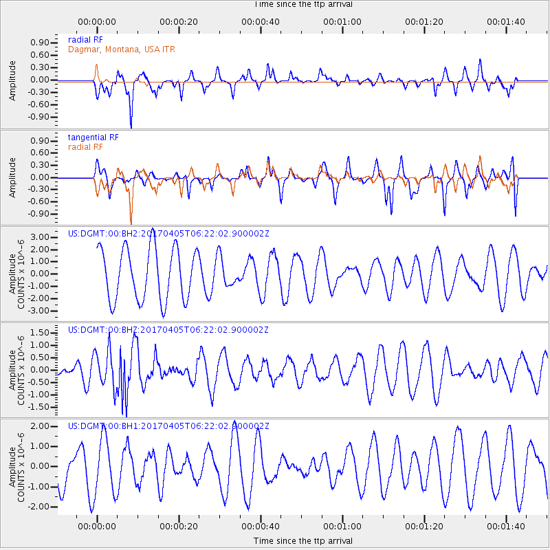
DGMT Dagmar, Montana, USA - Earthquake Result Viewer
*The percent match for this event was below the threshold and hence no stack was calculated.
| Earthquake location: |
Northern And Central Iran |
| Earthquake latitude/longitude: |
35.8/60.4 |
| Earthquake time(UTC): |
2017/04/05 (095) 06:09:12 GMT |
| Earthquake Depth: |
13 km |
| Earthquake Magnitude: |
6.1 Mww |
| Earthquake Catalog/Contributor: |
NEIC PDE/us |
|
| Network: |
US United States National Seismic Network |
| Station: |
DGMT Dagmar, Montana, USA |
| Lat/Lon: |
48.47 N/104.20 W |
| Elevation: |
0.0 m |
|
| Distance: |
95.0 deg |
| Az: |
349.802 deg |
| Baz: |
12.49 deg |
| Ray Param: |
$rayparam |
*The percent match for this event was below the threshold and hence was not used in the summary stack. |
|
| Radial Match: |
55.79151 % |
| Radial Bump: |
320 |
| Transverse Match: |
43.60433 % |
| Transverse Bump: |
287 |
| SOD ConfigId: |
2028011 |
| Insert Time: |
2017-04-19 06:12:21.236 +0000 |
| GWidth: |
2.5 |
| Max Bumps: |
400 |
| Tol: |
0.001 |
|
Signal To Noise
| Channel | StoN | STA | LTA |
| US:DGMT:00:BHZ:20170405T06:22:02.900002Z | 2.1490428 | 7.472983E-7 | 3.4773544E-7 |
| US:DGMT:00:BH1:20170405T06:22:02.900002Z | 1.229452 | 1.4013145E-6 | 1.139788E-6 |
| US:DGMT:00:BH2:20170405T06:22:02.900002Z | 0.5625725 | 1.185012E-6 | 2.1064168E-6 |
| Arrivals |
| Ps | |
| PpPs | |
| PsPs/PpSs | |


