You are here: Home > Network List > II - Global Seismograph Network (GSN - IRIS/IDA) Stations List
> Station WRAB Tennant Creek, NT, Australia > Earthquake Result Viewer
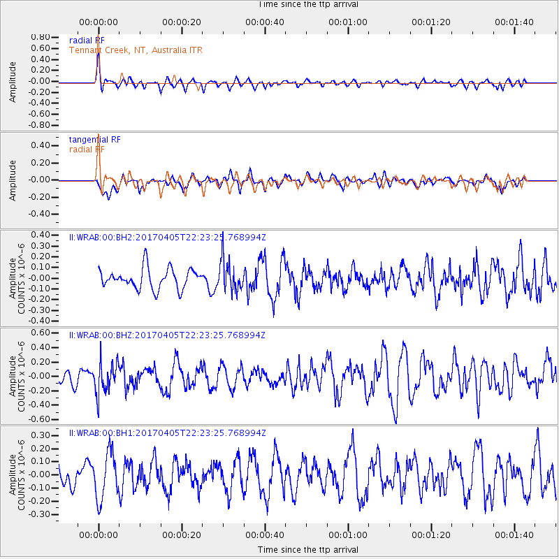
WRAB Tennant Creek, NT, Australia - Earthquake Result Viewer
*The percent match for this event was below the threshold and hence no stack was calculated.
| Earthquake location: |
Vanuatu Islands |
| Earthquake latitude/longitude: |
-19.0/169.6 |
| Earthquake time(UTC): |
2017/04/05 (095) 22:17:42 GMT |
| Earthquake Depth: |
248 km |
| Earthquake Magnitude: |
5.6 Mww |
| Earthquake Catalog/Contributor: |
NEIC PDE/us |
|
| Network: |
II Global Seismograph Network (GSN - IRIS/IDA) |
| Station: |
WRAB Tennant Creek, NT, Australia |
| Lat/Lon: |
19.93 S/134.36 E |
| Elevation: |
366 m |
|
| Distance: |
33.2 deg |
| Az: |
262.431 deg |
| Baz: |
94.432 deg |
| Ray Param: |
$rayparam |
*The percent match for this event was below the threshold and hence was not used in the summary stack. |
|
| Radial Match: |
55.214745 % |
| Radial Bump: |
400 |
| Transverse Match: |
49.46158 % |
| Transverse Bump: |
400 |
| SOD ConfigId: |
2028011 |
| Insert Time: |
2017-04-19 22:22:26.716 +0000 |
| GWidth: |
2.5 |
| Max Bumps: |
400 |
| Tol: |
0.001 |
|
Signal To Noise
| Channel | StoN | STA | LTA |
| II:WRAB:00:BHZ:20170405T22:23:25.768994Z | 1.6180536 | 2.1870993E-7 | 1.3516853E-7 |
| II:WRAB:00:BH1:20170405T22:23:25.768994Z | 1.8859843 | 1.8342837E-7 | 9.725869E-8 |
| II:WRAB:00:BH2:20170405T22:23:25.768994Z | 1.5448929 | 1.449972E-7 | 9.3855824E-8 |
| Arrivals |
| Ps | |
| PpPs | |
| PsPs/PpSs | |


