You are here: Home > Network List > TA - USArray Transportable Network (new EarthScope stations) Stations List
> Station D23K Nanushuk River, AK USA > Earthquake Result Viewer
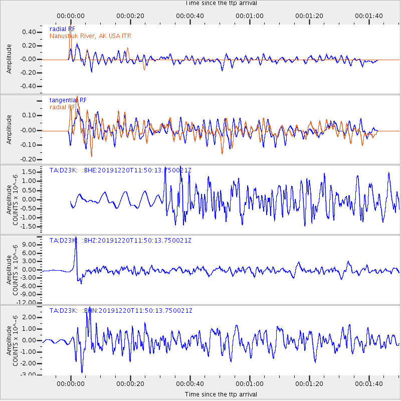
D23K Nanushuk River, AK USA - Earthquake Result Viewer
*The percent match for this event was below the threshold and hence no stack was calculated.
| Earthquake location: |
Hindu Kush Region, Afghanistan |
| Earthquake latitude/longitude: |
36.5/70.4 |
| Earthquake time(UTC): |
2019/12/20 (354) 11:39:52 GMT |
| Earthquake Depth: |
210 km |
| Earthquake Magnitude: |
6.1 Mww |
| Earthquake Catalog/Contributor: |
NEIC PDE/us |
|
| Network: |
TA USArray Transportable Network (new EarthScope stations) |
| Station: |
D23K Nanushuk River, AK USA |
| Lat/Lon: |
68.97 N/150.68 W |
| Elevation: |
406 m |
|
| Distance: |
70.5 deg |
| Az: |
14.587 deg |
| Baz: |
325.816 deg |
| Ray Param: |
$rayparam |
*The percent match for this event was below the threshold and hence was not used in the summary stack. |
|
| Radial Match: |
69.0106 % |
| Radial Bump: |
400 |
| Transverse Match: |
67.62146 % |
| Transverse Bump: |
400 |
| SOD ConfigId: |
20358551 |
| Insert Time: |
2020-01-03 11:58:20.799 +0000 |
| GWidth: |
2.5 |
| Max Bumps: |
400 |
| Tol: |
0.001 |
|
Signal To Noise
| Channel | StoN | STA | LTA |
| TA:D23K: :BHZ:20191220T11:50:13.750021Z | 20.48075 | 4.028685E-6 | 1.9670595E-7 |
| TA:D23K: :BHN:20191220T11:50:13.750021Z | 6.7549443 | 1.03195E-6 | 1.5276959E-7 |
| TA:D23K: :BHE:20191220T11:50:13.750021Z | 2.3876178 | 6.119933E-7 | 2.5631962E-7 |
| Arrivals |
| Ps | |
| PpPs | |
| PsPs/PpSs | |


