You are here: Home > Network List > TS - TERRAscope (Southern California Seismic Network) Stations List
> Station PAS Pasadena, California, USA > Earthquake Result Viewer
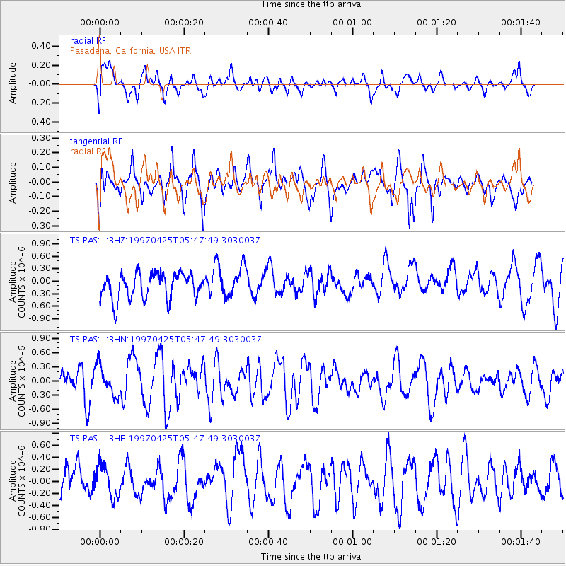
PAS Pasadena, California, USA - Earthquake Result Viewer
*The percent match for this event was below the threshold and hence no stack was calculated.
| Earthquake location: |
Kuril Islands |
| Earthquake latitude/longitude: |
46.2/153.1 |
| Earthquake time(UTC): |
1997/04/25 (115) 05:37:40 GMT |
| Earthquake Depth: |
33 km |
| Earthquake Magnitude: |
5.5 MB, 5.5 MS |
| Earthquake Catalog/Contributor: |
WHDF/NEIC |
|
| Network: |
TS TERRAscope (Southern California Seismic Network) |
| Station: |
PAS Pasadena, California, USA |
| Lat/Lon: |
34.15 N/118.17 W |
| Elevation: |
295 m |
|
| Distance: |
65.5 deg |
| Az: |
65.658 deg |
| Baz: |
310.211 deg |
| Ray Param: |
$rayparam |
*The percent match for this event was below the threshold and hence was not used in the summary stack. |
|
| Radial Match: |
58.71708 % |
| Radial Bump: |
400 |
| Transverse Match: |
64.909454 % |
| Transverse Bump: |
400 |
| SOD ConfigId: |
4480 |
| Insert Time: |
2010-02-26 14:38:23.658 +0000 |
| GWidth: |
2.5 |
| Max Bumps: |
400 |
| Tol: |
0.001 |
|
Signal To Noise
| Channel | StoN | STA | LTA |
| TS:PAS: :BHN:19970425T05:47:49.303003Z | 1.2423965 | 3.1280686E-7 | 2.51777E-7 |
| TS:PAS: :BHE:19970425T05:47:49.303003Z | 0.57756585 | 2.6946776E-7 | 4.6655762E-7 |
| TS:PAS: :BHZ:19970425T05:47:49.303003Z | 1.1590575 | 3.559948E-7 | 3.0714165E-7 |
| Arrivals |
| Ps | |
| PpPs | |
| PsPs/PpSs | |


