You are here: Home > Network List > US - United States National Seismic Network Stations List
> Station GLMI Grayling, Michigan, USA > Earthquake Result Viewer
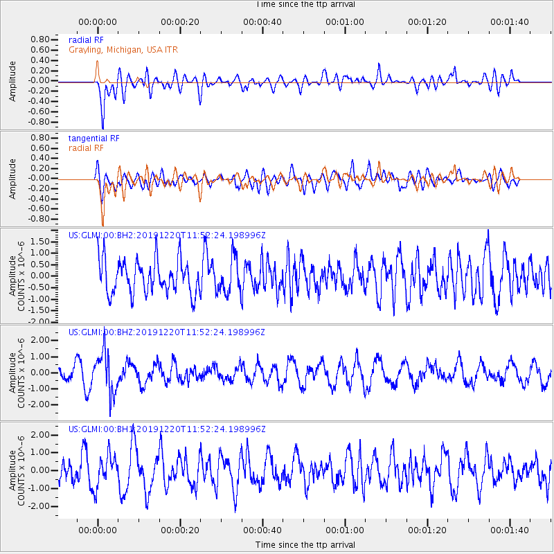
GLMI Grayling, Michigan, USA - Earthquake Result Viewer
*The percent match for this event was below the threshold and hence no stack was calculated.
| Earthquake location: |
Hindu Kush Region, Afghanistan |
| Earthquake latitude/longitude: |
36.5/70.4 |
| Earthquake time(UTC): |
2019/12/20 (354) 11:39:52 GMT |
| Earthquake Depth: |
210 km |
| Earthquake Magnitude: |
6.1 Mww |
| Earthquake Catalog/Contributor: |
NEIC PDE/us |
|
| Network: |
US United States National Seismic Network |
| Station: |
GLMI Grayling, Michigan, USA |
| Lat/Lon: |
44.82 N/84.62 W |
| Elevation: |
387 m |
|
| Distance: |
95.9 deg |
| Az: |
342.438 deg |
| Baz: |
19.969 deg |
| Ray Param: |
$rayparam |
*The percent match for this event was below the threshold and hence was not used in the summary stack. |
|
| Radial Match: |
58.524643 % |
| Radial Bump: |
400 |
| Transverse Match: |
46.44931 % |
| Transverse Bump: |
400 |
| SOD ConfigId: |
20358551 |
| Insert Time: |
2020-01-03 11:59:40.671 +0000 |
| GWidth: |
2.5 |
| Max Bumps: |
400 |
| Tol: |
0.001 |
|
Signal To Noise
| Channel | StoN | STA | LTA |
| US:GLMI:00:BHZ:20191220T11:52:24.198996Z | 2.5816548 | 1.2878503E-6 | 4.988469E-7 |
| US:GLMI:00:BH1:20191220T11:52:24.198996Z | 0.81702256 | 8.896079E-7 | 1.0888414E-6 |
| US:GLMI:00:BH2:20191220T11:52:24.198996Z | 1.0759907 | 7.7214037E-7 | 7.176088E-7 |
| Arrivals |
| Ps | |
| PpPs | |
| PsPs/PpSs | |


