BNI Bardonecchia, Italy - Earthquake Result Viewer
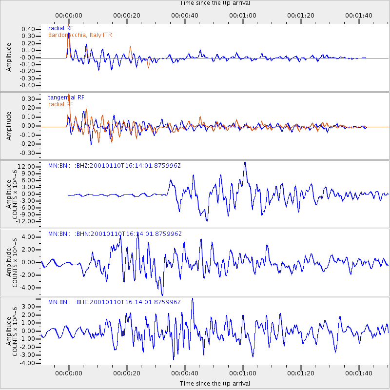
Earthquake location: Kodiak Island Region, Alaska
Earthquake latitude/longitude: 57.1/-153.2
Earthquake time(UTC): 2001/01/10 (010) 16:02:44 GMT
Earthquake Depth: 33 km
Earthquake Magnitude: 6.2 MB, 6.8 MS, 7.1 MW, 6.8 ML
Earthquake Catalog/Contributor: WHDF/NEIC
Network: MN MEDNET Project
Station: BNI Bardonecchia, Italy
Lat/Lon: 45.05 N/6.68 E
Elevation: 1395 m
Distance: 76.9 deg
Az: 14.494 deg
Baz: 348.883 deg
Ray Param: 0.050668895
Estimated Moho Depth: 18.5 km
Estimated Crust Vp/Vs: 1.84
Assumed Crust Vp: 6.416 km/s
Estimated Crust Vs: 3.487 km/s
Estimated Crust Poisson's Ratio: 0.29
Radial Match: 88.44926 %
Radial Bump: 400
Transverse Match: 85.237915 %
Transverse Bump: 400
SOD ConfigId: 3744
Insert Time: 2010-03-08 16:47:16.287 +0000
GWidth: 2.5
Max Bumps: 400
Tol: 0.001

Signal To Noise

ChannelStoNSTALTA
MN:BNI: :BHN:20010110T16:14:01.875996Z1.49036824.6435042E-73.1156756E-7
MN:BNI: :BHE:20010110T16:14:01.875996Z1.62181934.5589772E-72.8110267E-7
MN:BNI: :BHZ:20010110T16:14:01.875996Z3.56338671.0945128E-63.0715518E-7
Arrivals
Ps2.5 SECOND
PpPs7.9 SECOND
PsPs/PpSs10 SECOND