
BNI Bardonecchia, Italy - Earthquake Result Viewer
| ||||||||||||||||||
| ||||||||||||||||||
| ||||||||||||||||||
|
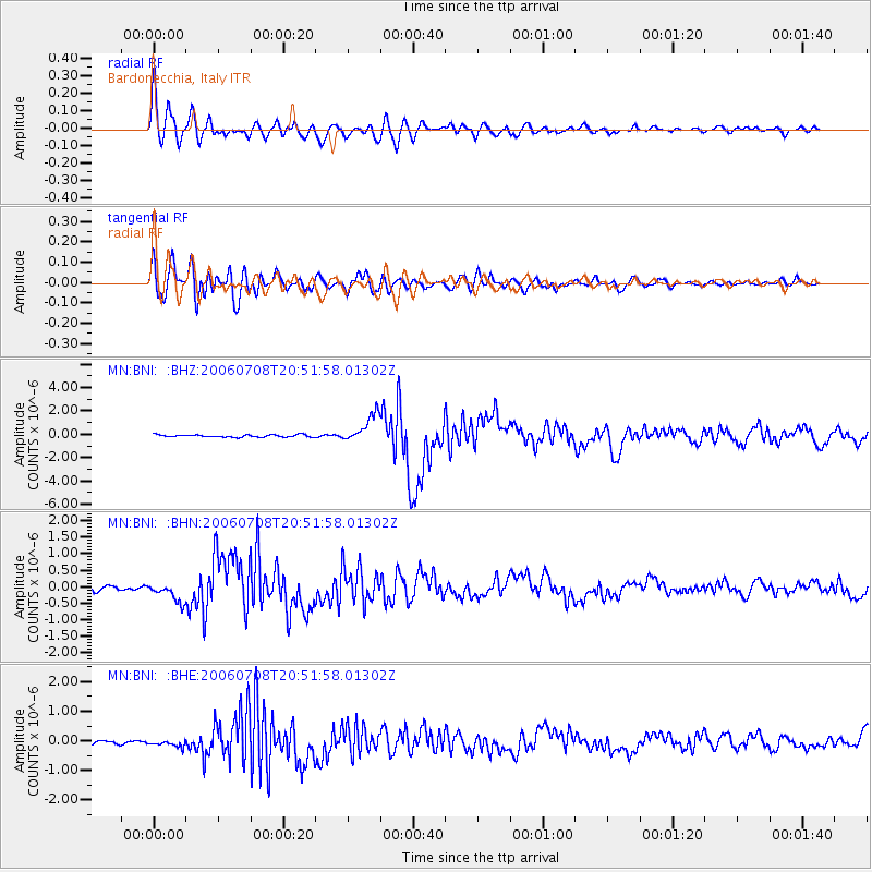
Signal To Noise
| Channel | StoN | STA | LTA |
| MN:BNI: :BHN:20060708T20:51:58.01302Z | 4.9348855 | 2.9114634E-7 | 5.8997585E-8 |
| MN:BNI: :BHE:20060708T20:51:58.01302Z | 1.3872395 | 1.08621414E-7 | 7.830041E-8 |
| MN:BNI: :BHZ:20060708T20:51:58.01302Z | 12.6463175 | 1.1980927E-6 | 9.473847E-8 |
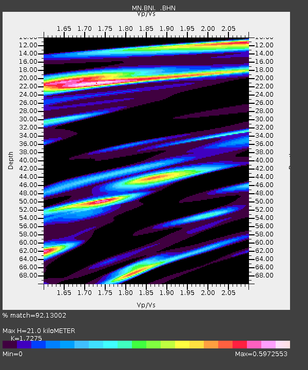
| Arrivals | |
| Ps | 2.4 SECOND |
| PpPs | 8.7 SECOND |
| PsPs/PpSs | 11 SECOND |

