You are here: Home > Network List > TA - USArray Transportable Network (new EarthScope stations) Stations List
> Station C16K Lisburne Hills, AK, USA > Earthquake Result Viewer
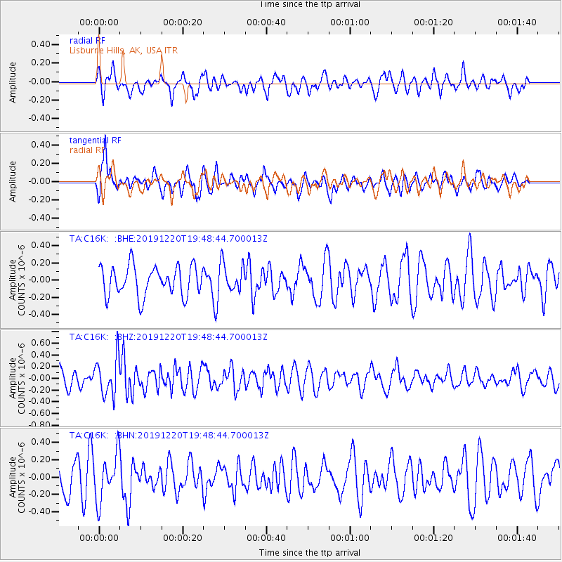
C16K Lisburne Hills, AK, USA - Earthquake Result Viewer
*The percent match for this event was below the threshold and hence no stack was calculated.
| Earthquake location: |
Southeast Of Honshu, Japan |
| Earthquake latitude/longitude: |
32.9/142.8 |
| Earthquake time(UTC): |
2019/12/20 (354) 19:40:52 GMT |
| Earthquake Depth: |
10 km |
| Earthquake Magnitude: |
5.3 Mww |
| Earthquake Catalog/Contributor: |
NEIC PDE/us |
|
| Network: |
TA USArray Transportable Network (new EarthScope stations) |
| Station: |
C16K Lisburne Hills, AK, USA |
| Lat/Lon: |
68.27 N/165.34 W |
| Elevation: |
102 m |
|
| Distance: |
46.0 deg |
| Az: |
24.029 deg |
| Baz: |
247.001 deg |
| Ray Param: |
$rayparam |
*The percent match for this event was below the threshold and hence was not used in the summary stack. |
|
| Radial Match: |
54.12526 % |
| Radial Bump: |
400 |
| Transverse Match: |
60.076206 % |
| Transverse Bump: |
400 |
| SOD ConfigId: |
20358551 |
| Insert Time: |
2020-01-03 19:52:26.260 +0000 |
| GWidth: |
2.5 |
| Max Bumps: |
400 |
| Tol: |
0.001 |
|
Signal To Noise
| Channel | StoN | STA | LTA |
| TA:C16K: :BHZ:20191220T19:48:44.700013Z | 1.5637858 | 3.3125923E-7 | 2.1183159E-7 |
| TA:C16K: :BHN:20191220T19:48:44.700013Z | 1.5639411 | 2.7540787E-7 | 1.7609862E-7 |
| TA:C16K: :BHE:20191220T19:48:44.700013Z | 0.9610341 | 1.655994E-7 | 1.7231375E-7 |
| Arrivals |
| Ps | |
| PpPs | |
| PsPs/PpSs | |


